Black Mesa

Place Name: Cimarron County
Place Description: State: Oklahoma
Date: 07/23/2021
Elevation: 4,973 Feet
Prominence: 0 Feet
Miles: 9.2
Elevation Gain: 740 Feet
Lists: US State High Points
-
Difficulty
-
Solitude
-
Kid Friendly
-
Summit Views
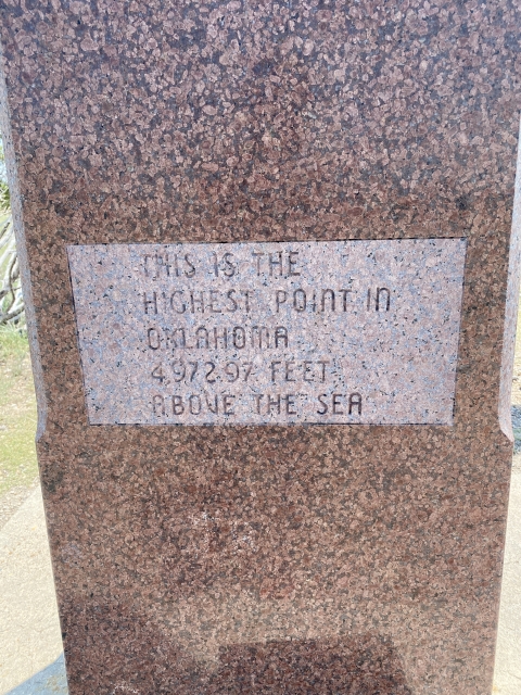
The Highest Point In Oklahoma
Black Mesa is an extremely long and wide mesa that spans three states. Where is crosses the Oklahoma panhandle near the New Mexico border is the highest point in the state and attracts high pointers from all over the place.
Overall
3Pros
- Good access road
- Nice trail
- Lots of peace and quiet
Cons
- Very desolate country
- Snake country
- Can be very hot
State high pointing is super fun and takes one to some random areas. One of these such areas is Black Mesa in Oklahoma, the highest in the state.
The actual mesa runs many miles over three states, however, where is crosses the far northwest corner of Oklahoma, it gets its famous distinction.
Getting There
This is the fun part. This trail is in the middle of nowhere! From Boise City, OK, we headed west towards Kenton, OK. This was a lonely two-lane road that is heavily weathered. We only passed one other car.
Boise City has gas and stores, Kenton does not have anything. To access Black Mesa, we turned off before Kenton and headed north around the east side of the mesa to the large parking lot at the trailhead. There is no cell service with Verizon and decent coverage with AT&T out here. We had to assist and older fellow with a flat tire when we arrived at the parking lot.

Starting point of Black Mesa Trail.
The Trail
After two simple state high points the day before – Panorama Point, NE and Mount Sunflower, KS – it was nice to get out and actually have to hike to one.
The mesa country is flat, except for the mesas and dotted with juniper trees, cholla cactus, and cattle. It’s like walking through the set of an old John Wayne movie. This really is no man’s land out here, as one local described it.

Looking down at the lower trail.
Fortunately, we had nice weather, upper 80s with a stiff breeze. I can only imagine it gets very hot here. The trail is mostly an old dirt road that follows dry flat land before turning left towards the mesa. The gain on the entire trip is only 740 feet, around 500 of it is gaining the mesa top and is very easy walking up to the, you guessed it, flat top of the mesa.

View of the mesa top
The Summit
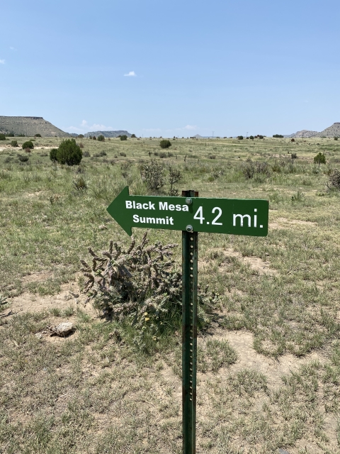
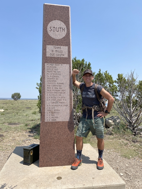
Once on top the mesa, the walk is still another mile or so to the obelisk at the high point. The mesa is very wide and flat all the way to highest point, which doesn’t look any different than the rest of the area.
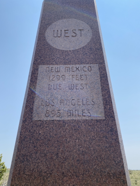
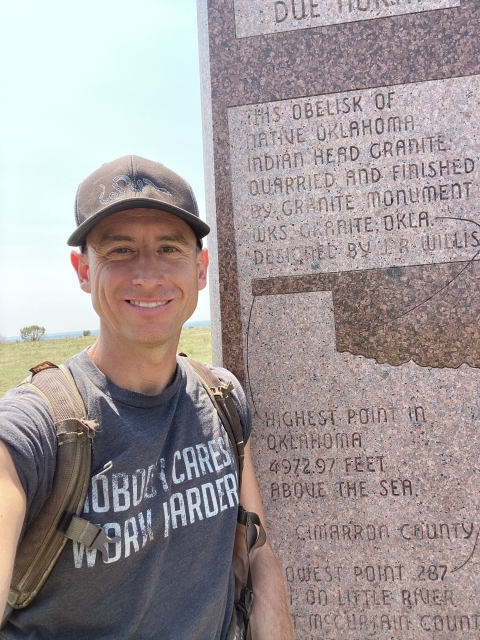
The obelisk is very pretty and tells you how far you are from neighboring states and cities like LA and NY.

We spent a bit of time here and then walked towards the state border with New Mexico which was about .25 miles away. There was nothing marking the border.

Trail towards the NM border on to of the mesa.
The Final Word
Black Mesa is an easy hike in the middle of nowhere. The scenery is pretty if you like this type of country. We only saw a couple of other people the entire day. Other than, all we saw were cows.
If taking a trip out here, make sure you come stocked with water and food. Having a satellite emergency beacon is a good idea too. This is legit back country.
We did this as a loop of state high points tagging Nebraska and Kansas the day before and New Mexico the next day.