Dunderberg Peak

Place Name: Mono County
Place Description: State: California
Date: 09/16/2022
Elevation: 12,374 Feet
Prominence: 1,334 Feet
Miles: 7.3
Elevation Gain: 3,340 Feet
Lists: Sierra Peaks Section, Sierra Sampler, Western States Climbers
-
Difficulty
-
Solitude
-
Kid Friendly
-
Summit Views
An Eastern Sierra Gem
Dunderberg Peak is highly visible from US-395 in the Bridgeport area. It’s 3 distinct bumps just beg to be climbed and can be done with a fairly short and non-technical ascent.
Overall
3.1Pros
- Good access road
- Great views
- Lots of peace and quiet
Cons
- No trails
- Some loose rock
- Exposed to elements
From Conway Summit and the Bridgeport area, Dunderberg Peak and it’s 3-bump summit are very distinguishable. The 12,374-foot summit just beckons and calls unsuspecting peak baggers driving down US-395.
Making the trip to the summit is something I highly recommend.
Getting There
There are a couple of ways to climb Dunderberg Peak and they all start by using Virginia Lakes Rd. This road is located south of Bridgeport off 395.
If starting from Virginia Lakes, you will drive to the end of the road at the large parking area and ascend the steep talus from the Virginia Lakes Basin.
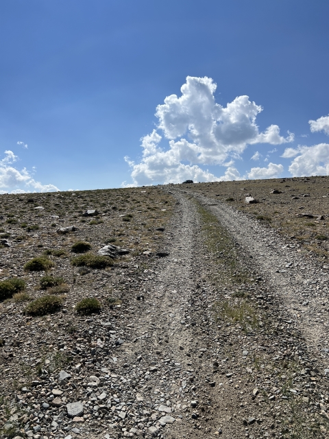
If you have a little more time (and sanity) you will turn off before here on a dirt Dunderberg Meadows Rd. This road is passable to all cars up to the turn off with Kavanaugh Ridge Rd.
Kavanaugh Ridge Rd is a jeep trail the ends at the edge of the Hoover Wilderness.

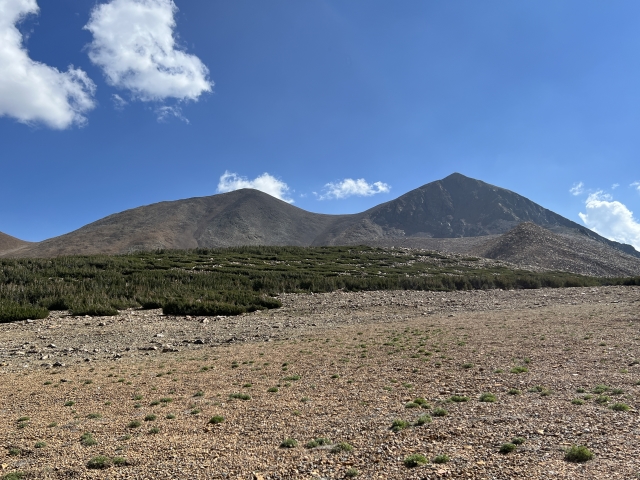
Looking down at the end of the road.
Parking at the Kavanaugh Ridge sign and walking up the road a bit is an option. The shortest option is driving to the road’s end and starting straight up the scree field to the summit.
The Trail
During our trip, we started from the Kavanaugh Ridge Rd sign and followed the road for a bit. On the return, we came down the scree field in the saddle and down to road’s end. After a mile or so, you can break off to the left and start working your way up the slopes toward the false summit.

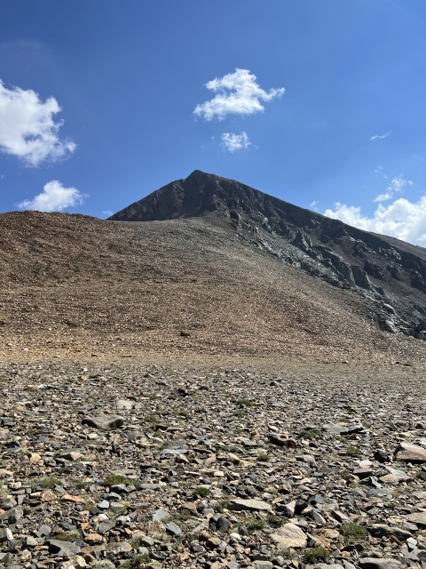
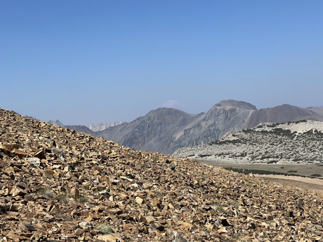
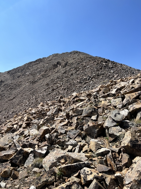
The three bumps of Dunderberg Peak lie ahead
The rock is loose and not the greatest, however, it’s nowhere the worst I’ve ever seen. After reaching the false summit, you will have to drop a bit and climb up to the eastern summit. There is a nice view out Mount Dana along the way.

Headed towards the lower east summit from the false summit.
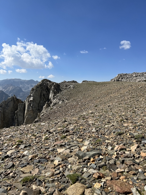
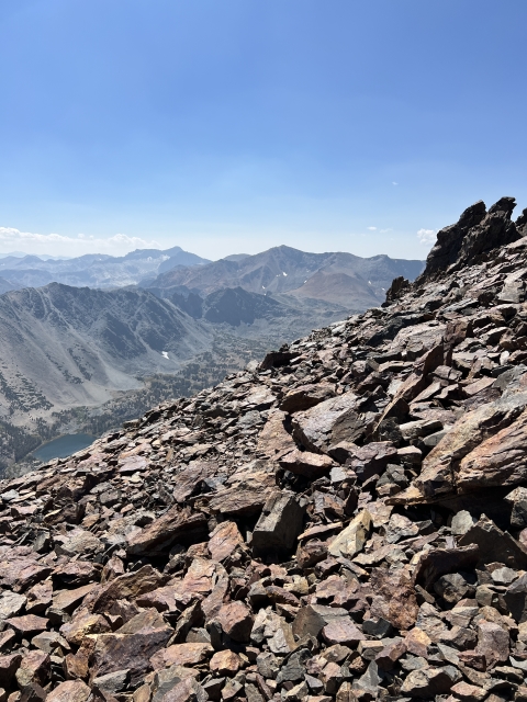
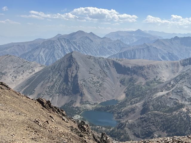
This section was fairly steep and had the shiftiest rocks of the day. Once on the east summit, the views really open up and the route to the real summit is in plain sight.

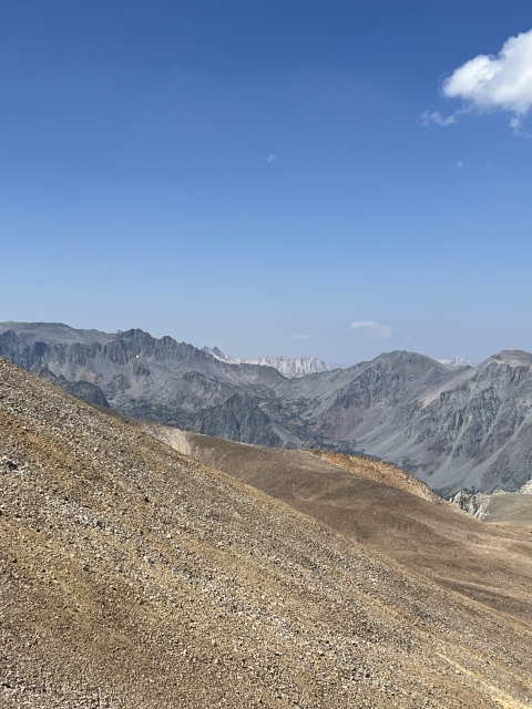
The true summit lies ahead.
Drop down and angle left to follow the ridge through the saddle. Then climb up to the summit ridge and head north to the top.

Nearing the summit
The Summit
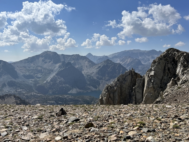
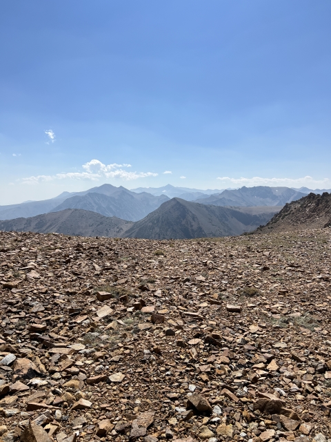
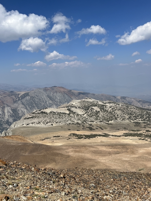
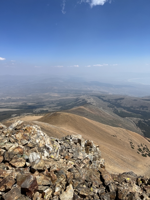
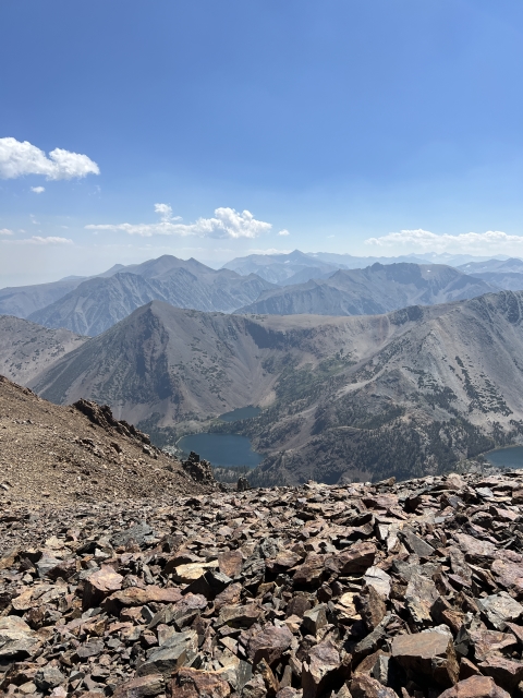
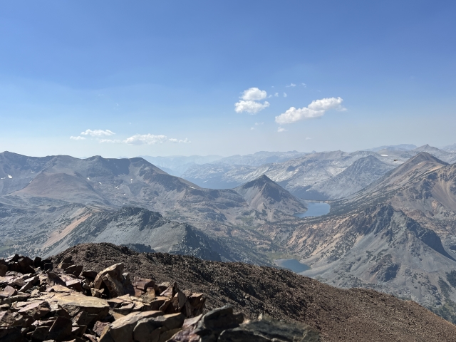
Dunderberg sits right on the edge of the Hoover Wilderness and gives you a bird’s eye view into the deep basin below. Lakes and peaks are everywhere.


Hoover Wilderness
To the east, Mono Lake is highly visible on a clear day. Wildfire smoke snuffed out the nice views to the east.
For the descent, we backtracked to the saddle and found a use trail down the steep gully. During parts of this section, a creek runs below the talus and is never seen, however, it makes a beautiful sound. Even though the gully is steep and loose at times, I believe it will make a nice ascent route as well.

Look back at the summit (right) and our descent gully.
The Final Word
Dunderberg Peak is a high-quality peak. Even though it’s a short hike to be able to bag its summit, you will have to work for it.
As said before, there are multiple routes to climb Dunderberg Peak. Just choose the one that fits your skill and timeframe the best.
If you are like me, this will only pique your interest of climbing more peaks in the Hoover Wilderness!


 and our descent gully.")