Glass Mountain

Place Name: Mono County
Place Description: State: California
Date: 08/21/2022
Elevation: 11,160 Feet
Prominence: 3,180 Feet
Miles: 3.2
Elevation Gain: 1,949 Feet
Lists: Great Basin Peak List, Desert Peaks Section, Desert Summits Book Peak List, California P2K
-
Difficulty
-
Solitude
-
Kid Friendly
-
Summit Views
A Shiny Piece Of Glass
Glass Mountain is a shiny piece of glass in a sea of beauty known as the Eastern Sierras. With an 11,000-foot summit, Glass Mountain is a shining example that Mono County is more than Sierra peaks and alpine lakes.
Overall
3.9Pros
- Good access road and trail
- Great views
- Solitude
Cons
- Long way out
- Steep and sandy
- Could be hot in summer
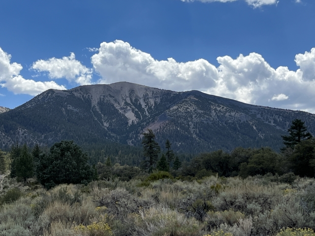
The Mono Lake Basin is home to a volcanic past, part of that past is the Glass Mountain Ridge that lies in the eastern end of the valley.
Glass Mountain is a beautiful peak that rises to 11,160 feet. With a spot between the Sierras and the White Mountains and over 3,000 feet of prominence, the views are epic in all directions.
Getting There
As far as Desert Peaks Section and Great Basin List Peaks go, Glass Mountain has a very easy approach.
From Highway 395, south of Lee Vining, take Highway 120 to the east for approximately 35 miles. Look for a sign marking Black Canyon Road off to the right. Take this turn and follow it for about 1 mile. Turn right at the signs marking Sawmill Meadows Rd.

Junction of Black Canyon Rd and Sawmill Meadows Rd.
These roads are all very wide dirt roads with minor wash boarding. Most of the time you can drive 30-40mph.

Sawmill Meadows Rd.
Follow Sawmill Meadow Road to an intersection with McGee Canyon Road. Turn left and drive to the trailhead. There are no markings for the trailhead, however, there is a large, downed tree blocking an old forest road.

Junction of Sawmill Meadows Rd and McGee Canyon Rd.
Pavement to trailhead is approximately 10.1 miles. If you continue past the trailhead, there is a campground further down the road.

Parking area and TH
The Trail
Even though there are no official trails out here, there is a very nice trail all the way to the summit. This is more than just your standard use trail; it may as well be official.
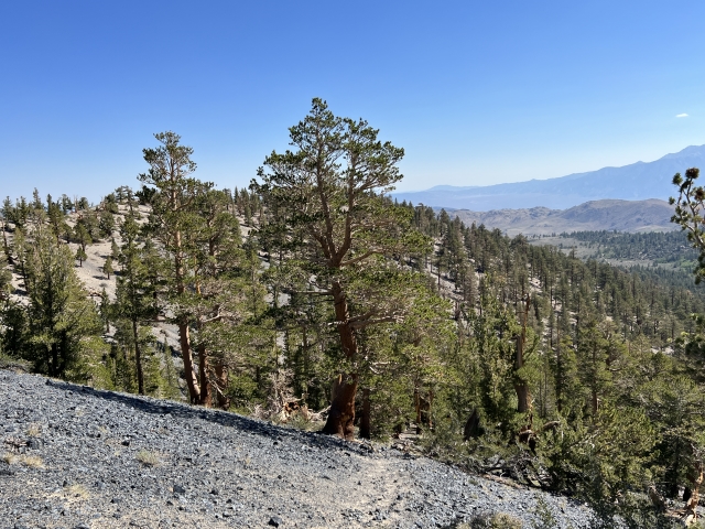
The forest road peters out shortly into the hike and then the trail begins. It’s hard to lose the trail as it climbs through an open forest.

Start of the trail to Glass Mountain.
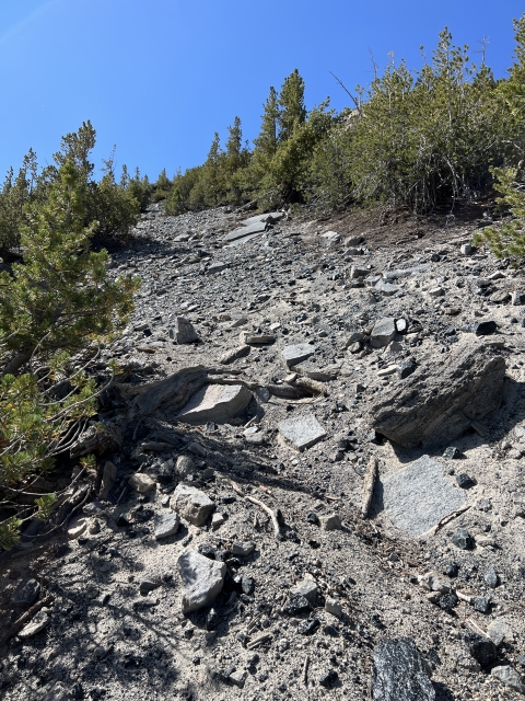
Even though the trail is short, it’s steep and sandy, you can expect to gain about 1,900 feet in 1.5 miles.
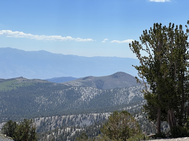
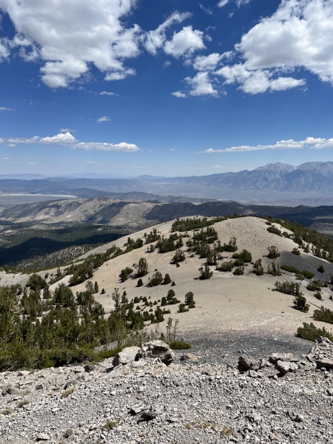
After climbing out of a gully, it follows a little ridge through some large fields of obsidian.

Glass Mountain Trail
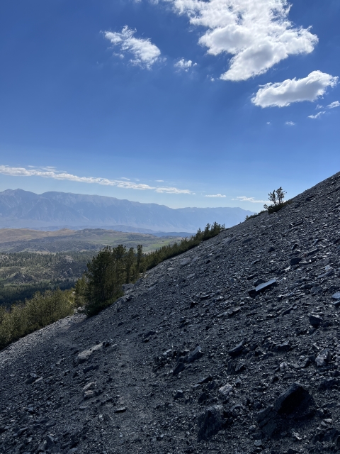
As you get higher, there is a Rocky outcrop and the trail sneaks around it to the right and climbs into a large basin.

Entering the upper basin.
Once in the basin, the summit lies just ahead.

The summit comes into view.
The Summit
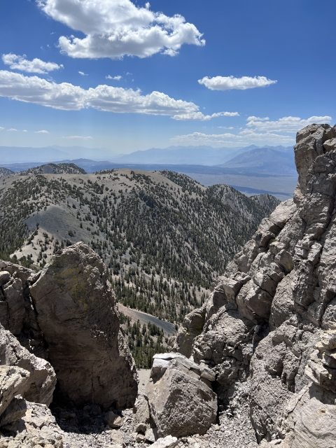
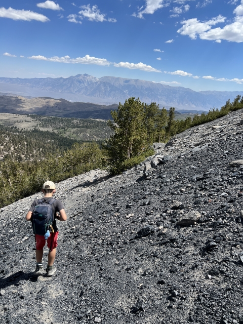
Glass Mountain’s summit has some amazing views. The Sierras loom large to the west with views all the way down into the Palisades.
To the east, White Mountain Peak, Montgomery Peak and Boundary Peak dominate the skyline.

View over to White Mountain Peak.
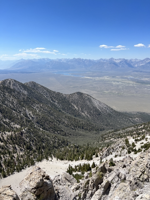
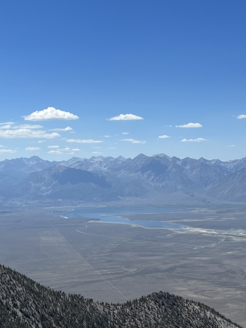
Crowley Lake is visible in the valley directly below and Mono Lake makes an appearance just beyond the northern summit.

Summit view of Crowley Lake.
The Final Word
Although Glass Mountain is a super cool peak it doesn’t get much visitation. To be fair, it’s pretty far out there and most people are enamored by the Sierras and won’t venture east of Highway 395.
The entire range can be traversed and made into a nice loop hike picking up an extra 4 peaks. There is a lot of beta out there in this type of excursion and the route looks fantastic! Definitely a hike worth checking out.

View of the Glass Range