Reynolds Peak

Place Name: Alpine County
Place Description: State: California
Date: 10/01/2021
Elevation: 9,680 Feet
Prominence: 760 Feet
Miles: 10
Elevation Gain: 2,122 Feet
Lists: Tahoe Ogul, Western States Climbers Emblem
-
Difficulty
-
Solitude
-
Kid Friendly
-
Summit Views
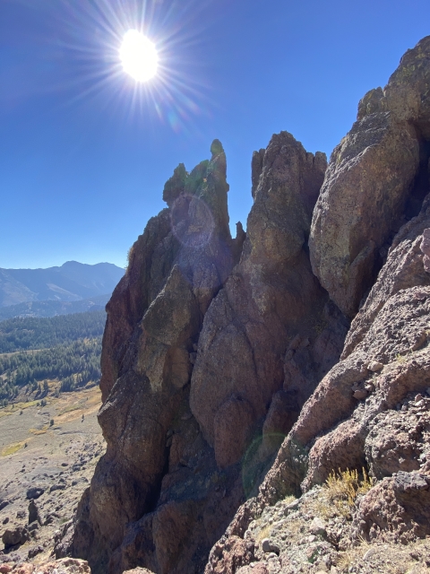
A Volcanic Maze
Reynolds Peak sits just north of Ebbett’s Pass along the PCT. It’s a very rugged and crumbly looking mountain and this is absolutely true when you get up on it. The summit block is comprised of a class 2/3 climb and has some major exposure.
Overall
3Pros
- PCT Walking is easy
- Path up the mountain can be found
- Lots of peace and quiet
Cons
- Loose and crumbly
- Scary summit
- Least favorite Ogul
Just north of Ebbett’s Pass, the Sierras become very volcanic. One such peak in the area is Reynolds Peak.
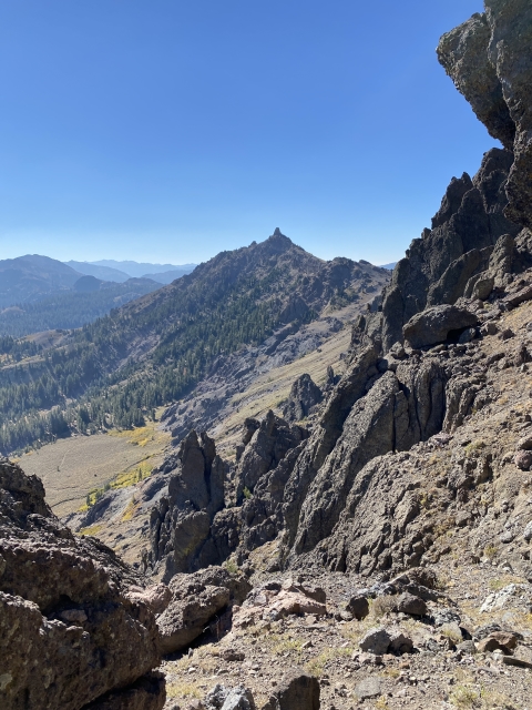
Reynolds Peak is seen from all over the eastern part of Carson Pass and Carson Valley, it looks like a jagged hump that almost connects to another jagged looking peak Raymond Peak. Both of these peaks lie just off the Pacific Crest Trail and take up spots on the Tahoe Ogul List. Both peaks are known to be of the spicier variety for this list.
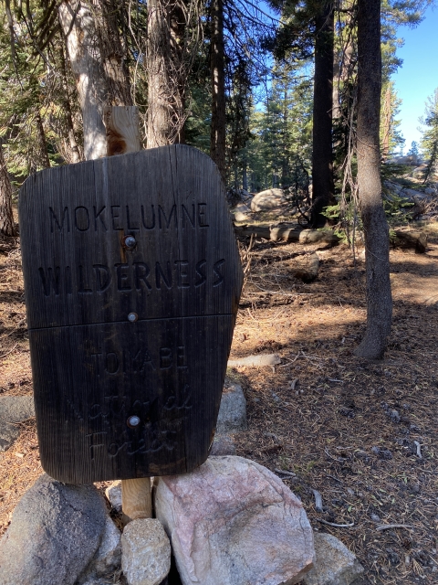
Getting There
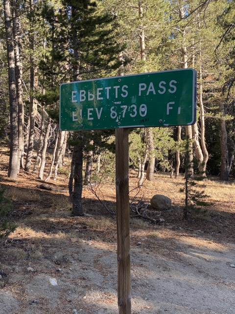
Access to Reynolds Peak is easy. Driving to the summit of Ebbett’s Pass on CA-4 and parking along side the highway is all you need to do. CA-4 connects the central valley to the Markleeville area. There is plenty of parking along the highway and the PCT crosses the road a short ways down.

The Trail
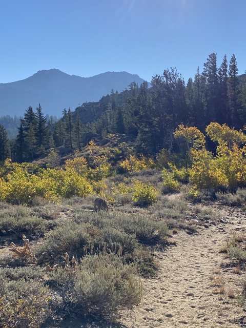
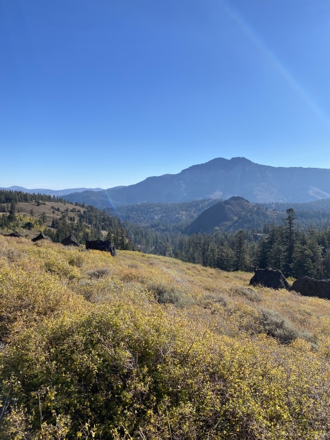
The easiest way to Reynolds is by hiking along the PCT. This section of the PCT is very pretty and passes along the shore of Sherrold Lake underneath Ebbett’s Peak.

Sherrold Lake and Ebbett’s Peak.
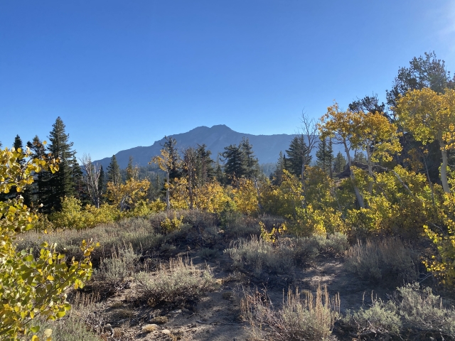
The trail then leads through the forest before giving way to open meadows with big views.
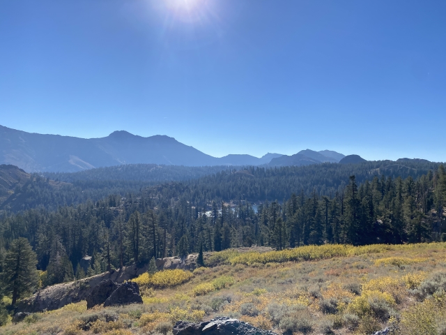
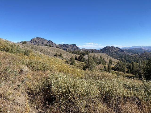
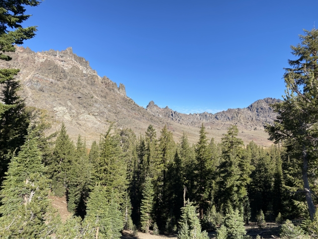
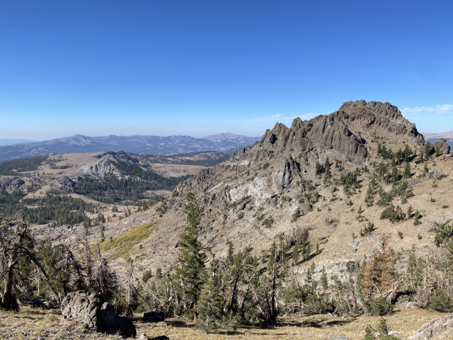
Reynolds Peak and Raymond Peak quickly come into view showing just what you are in for. From this vantage point, it’s hard to figure out where exactly to ascend the volcanic maze up to the ridge line.

View towards Reynolds Peak (Center) and Raymond Peak (Right)
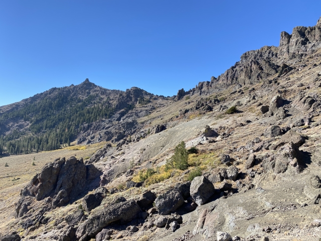
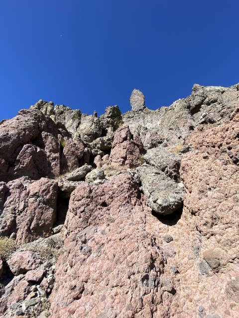
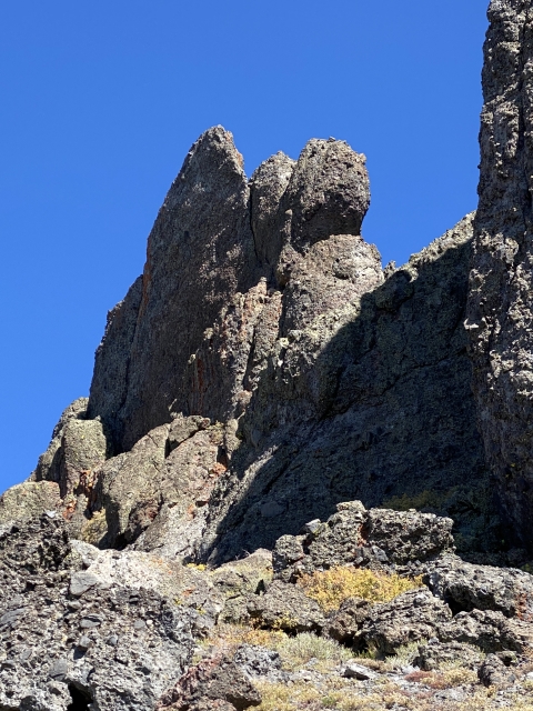
After about 4 miles of easy PCT walking, head up the gully towards the north end of the peak. It’s not apparent at first, however, there is nice class 2 route up through the loose rocks.

Class 2 chute.
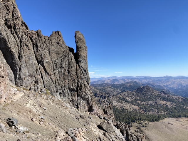
Although it’s a bit loose at times, the climbing is pretty easy and the ridge is gained. From the ridge, head over the west side of the mountain and then north under the outcroppings and to the summit area.
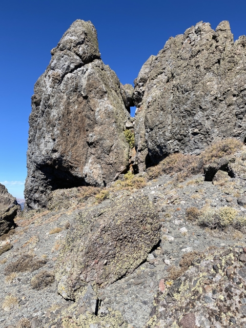
The Summit
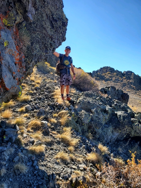
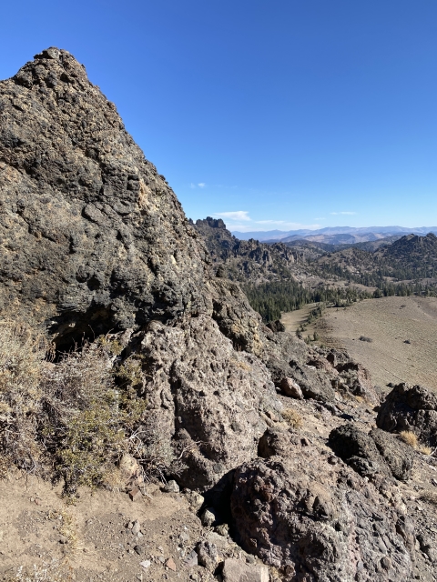
Once at the base of the summit block, the route is self explanatory. Just follow the spine of the ridge. The volcanic rock is pretty stable and the first part starts with an easy non-exposed class 3 climb.

Class 3 on summit block.
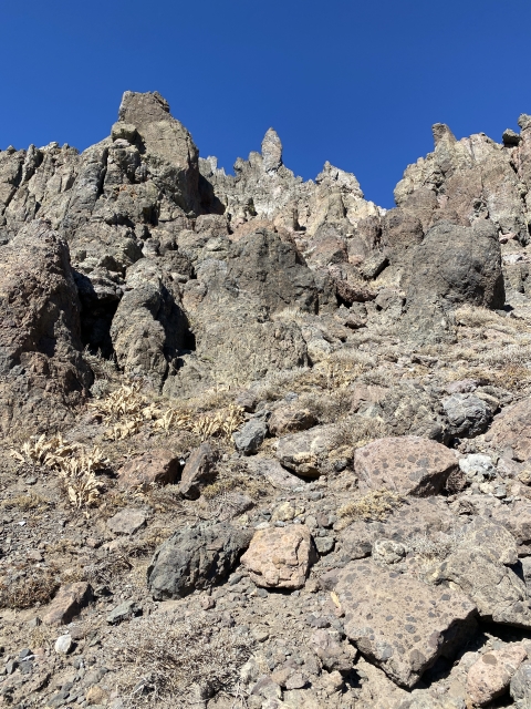
Once above this spot, the exposure comes into play. There is a large boulder that requires a very exposed step across move to access the final 15 feet. It is very airy and while most people just go right across, if I had to do it over, I would protect it.

The crux of the summit block. Major exposure on left.
The less exposed spot just to the right of the boulder that can also be used. This area is angled and a little longer of a climb. The holds didn’t look very god either. Slipping here, you run the risk of sliding down sort of a funnel and off the east side. Falling on either side would without a doubt result in death. I would advise not to attempt this peak on on a windy day.
The Final Word
I did not like Reynolds Peak at all and feel that it doesn’t really fit the nature of the rest of the Ogul List. Why this one and Jeff Davis Peak were added to a list of mostly class 1 and 2 walkups is kind of a head scratcher.
It is a cool looking peak and I actually enjoyed the route finding up to the ridge, however, unless you are keen on finishing the 63 Oguls, I would skip this one.


 and Raymond Peak (Right)")