Lewiston Peak

Place Name: Tooele County
Place Description: State: Utah
Date: 07/20/2021
Elevation: 10,411 Feet
Prominence: 211 Feet
Miles: 9.3
Elevation Gain: 3,539 Feet
Lists: Great Basin Peaks List
-
Difficulty
-
Solitude
-
Kid Friendly
-
Summit Views
A Random Great Basin Listed Peak
The Great Basin Peaks List spans 115 peaks over 5 states. The furthest peak to the east is Lewiston Peak in Utah’s Oquirrh Range. This lesser known peak lies 1 mile away from the ultra prominent Flat Top Mountain and the two make for a great combo!
Overall
3.8Pros
- Great views
- An actual trail
- Lots of deer
Cons
- Private property issues
- Very rough road
- Trail partially overgrown
There are 8 Ultra Peaks in Utah, if one was ever forgotten, it would be Flat Top Mountain. As the high point of the Oquirrh Mountains, a range that lies just west of Salt Lake City, it is close to urban area, but gets far less visitation than peaks like Deseret and Timpanogos.
If it wasn’t for Lewiston Peak’s inclusion on the Great Basin Peak List, I know I wouldn’t have prioritized this mountain either.
Getting There
Bagging Flat Top Mountain and Lewiston Peak require some work well before you get there. Part of this trail crosses private land and reaching out to the owner for permission is required. I sent an email and had a quick reply 3 hours later saying that we were good to go.
From Tooele, head south on UT-36 to UT-73 where you will turn left and drive towards the living ghost town of Ophir, UT.
Follow along Ophir Canyon Rd and make a right onto the first road after the town. The dirt road will take you to a large parking area with a bunch of interpretive signs and a trail head. If you don’t have a 4×4, this is your trailhead.
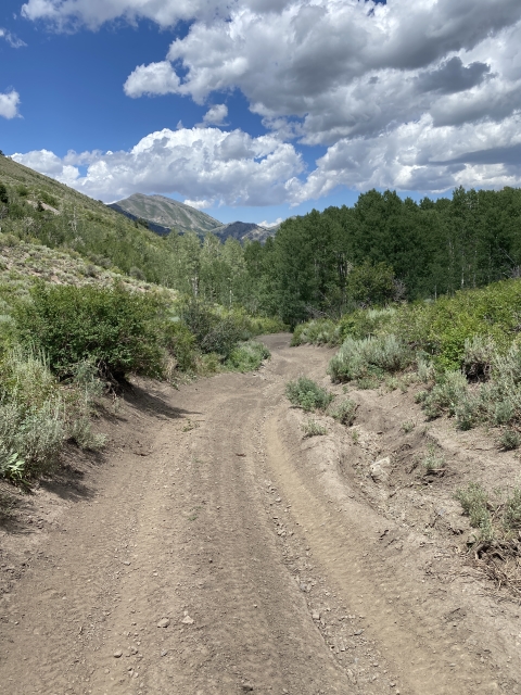
The road turns bad very quickly and the next 1-2 miles is a total rock crawl. My Tacoma handled it with ease. We parked lower than we should have and ended up with a mile of road walking. If you made it past the rock crawling, the road is no worse after that. It’s actually mostly better and you can park much higher up at another dirt parking area.

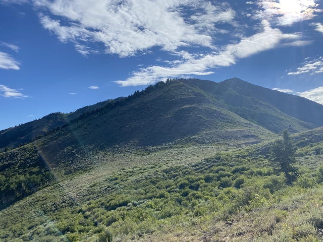
The top of the road.
The Trail
From the upper parking area, a trail starts and switchbacks up through the sage brush, mostly avoiding the heavy bushwhacking. It’s a bit overgrown, however, it will take you right to the top of the first ridge. We jumped 4 nice bucks in this area.

First ridge above the parking area.
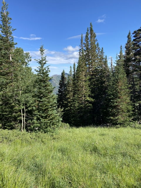
After gaining the ridge, follow this trail through high open country until it enters a beautiful pine forest. This section is quite nice and shaded. We even jumped a couple of does in here.

Into the forest section.
At this point you are just below Lewiston Peak and will make a switchback up higher into the forest. This spot is marked by all of the private property signs and where the required permission comes into play.

Private Property Area.
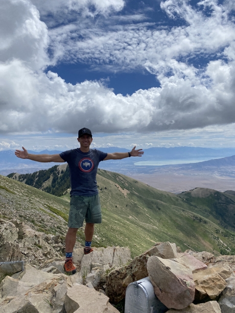
Lewiston Peak
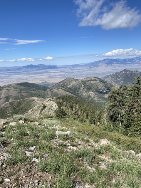
Once out of the forest, follow the open ridge right to the summit of Lewiston Peak. Despite not having 300 feet of prominence, Lewiston is a pretty mountain. It’s kind of an odd inclusion on the Great Basin Peak List, although I’m glad my quest for that list brought me here.

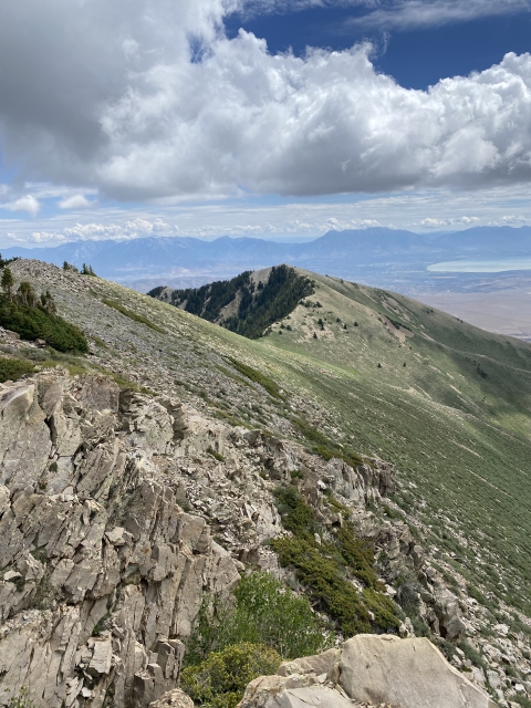
The final ridge up to Lewiston Peak.
While on the summit, the army was blowing stuff up in the desert below. We would hear loud booms and light shaking.

Army blowing stuff.
The ridge over to Flat Top Mountain looks very inviting and easy from here, however, we had some storm clouds building north of the summit. My son was also having a bit of a fit and we considered not going for it. Thankfully we did.
Flat Top Mountain
The traverse over starts with a quick drop off Lewiston back through the pines and then out to the open ridge. The saddle doesn’t dip very far and the mile walk is easy peasy over to Flat Top.

Ridge traverse over to Flat Top Mountain.
A couple of areas with talus slows you down a tad, although not much.
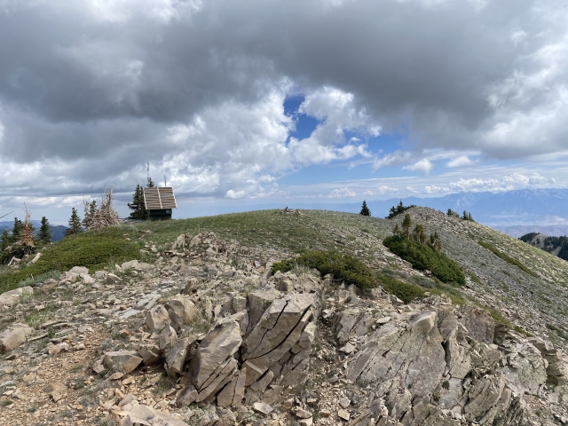
The summit is marked by a radio antenna and a silver mailbox for a summit register. Views are enjoyable even though they aren’t as expansive as other ultras I have been on.

Flat Top Mountain register.
With the clouds building, we high tailed it off the mountain and made quick work of the return trail. On the way back, a use trail connects the Flat Top Ridge to the trail below Lewiston, avoiding a second ascent up that one.
The Final Word
Is Flat Top Mountain the most amazing mountain in the world? Not at all. However, it’s a great half day adventure in Utah and a chance to get two cool peaks.
This would be a great one to combine with Deseret Peak across the valley to the west on a multi day trip. I wish we would have done just that.
I’m glad we made this a priority on our road trip and am very thankful for the permission to cross over private land to knock this out.