Mount McLoughlin

Place Name: Jackson County
Place Description: State: Oregon
Date: 10/09/2021
Elevation: 9,495 Feet
Prominence: 4,455 Feet
Miles: 9.9
Elevation Gain: 3,916 Feet
Lists: Oregon County High Points, Cascade Volcanoes Peak Pin, Oregon's Top 100 Peaks
-
Difficulty
-
Solitude
-
Kid Friendly
-
Summit Views
Let's Climb A Volcano!
Mount McLoughlin is a dominating presence in Southern Oregon and has a great trail all the way to the top. The summit views from this volcano are unmatched and is a must climb!
Overall
3Pros
- Awesome views
- Well maintained trail
- Great parking
Cons
- A little loose and scrambly towards top
- Main trail is popular
- Parking lot could fill up
Like all the Cascade Volcanoes, Mount McLoughlin is a dominating presence on the Oregon skyline.
As the tallest mountain in Southern Oregon, it easily stands out from the pack in the mountains between Medford and Klamath Falls.
While it’s eruptive behavior is ancient history, what it left behind over 20,000 years ago is a fun playground for humans today.
Getting There
Whether you are coming from the east or the west, accessing Mount McLoughlin is from OR-140. There,, are two different forest roads that access the trailhead. If coming from the west, the first road is signed “Summit Trailhead.” Reports say that this road is a bit rough, although, I did not try it. The map labels it as NF-3650.
Driving past this a couple miles on 140, a brown sign will be pointing to the turnoff to Fourmile Lake. This is a good road, high speed dirt and is called Fourmile Lake Rd. Follow this to the 4-way intersection and turn left onto NF-3650. The Trailhead parking area is a short ways down on the right side. Can’t miss it.

Mount McLoughlin TH
The Trail
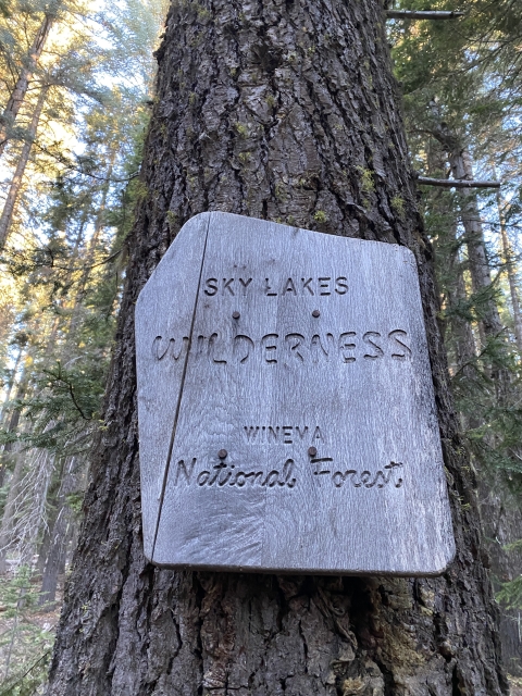
While the Mount McLoughlin trail is known for being steep, it certainly doesn’t start that way. The first few miles gain very little elevation as it meanders through a beautiful old growth forest. About 3/10 of a mile in, pass the Sky Lakes Wilderness sign.

Mount McLoughlin trail.
At the one mile mark, the trail intersects with the Pacific Crest Trail which you follow for about 1/2 mile. Although this is short, the PCT breaks off and you follow the main Mount McLoughlin Trail again.
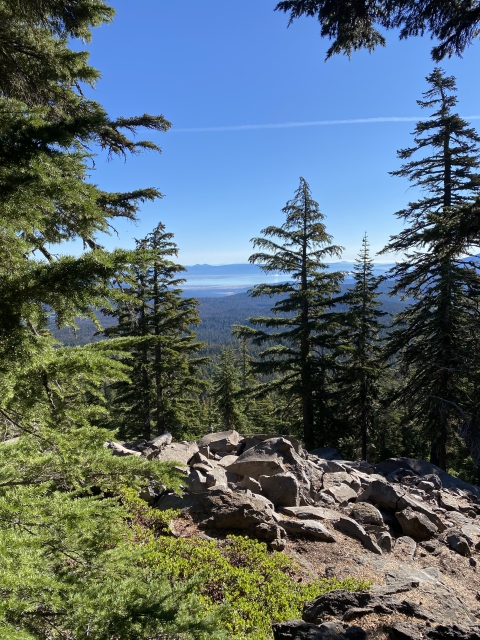
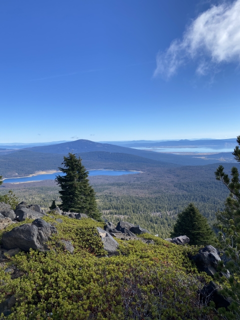
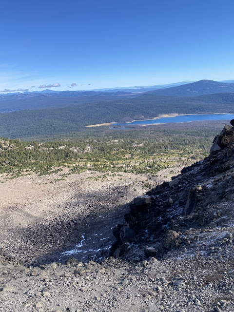
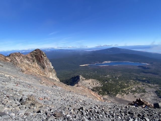
The trail starts climbing a little more and at times you can catch a glimpse of the summit through the trees. As you start to climb, views open towards the northeast. The views of Fourmile Lake, Klamath Lake, and Pelican Butte are beautiful. Mount Scott and the peaks around Crater Lake also come into focus.

View of Fourmile Lake, Pelican Butte, and Klamath Lake.
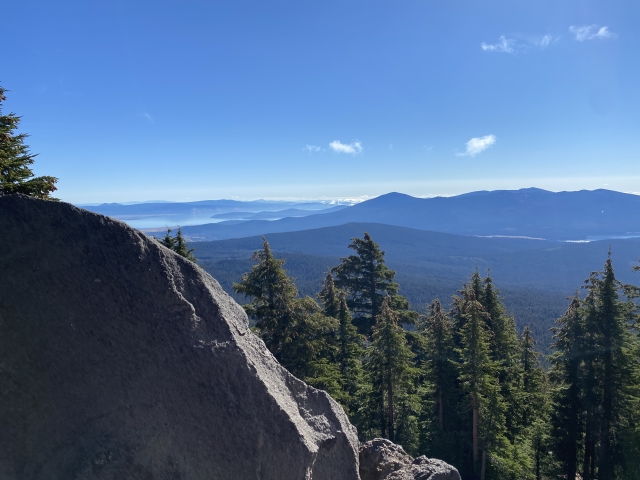
Further up, the trail starts to open up a bit and the trees thin out. Views towards Mount Shasta are a premium.

Mount Shasta and Mount Eddy come into view.
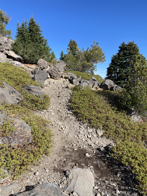
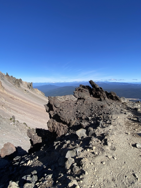
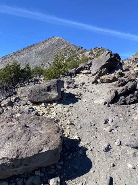
As you climb, the trail becomes completely exposed to the sky and the terrain is very rocky and all uphill. The trail comes in and out of the rocks and could be easy to lose if not paying attention. Although many rocks have white spray paint marking the way, they are easier to see on the way down.

Mount McLoughlin Trail. Look for the white paint.
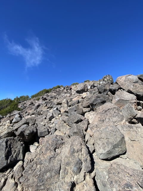
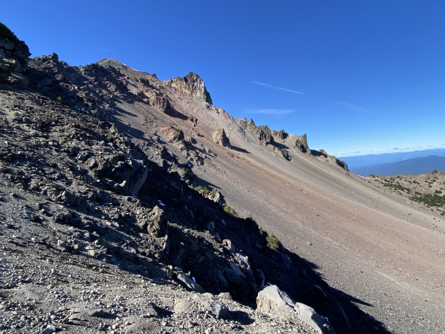
With about 1/2 mile left, pop out on the exposed ridge line and take in the views of the summit and the steep ridge you have to climb ahead. It will gain 1200 feet over this stretch.

Mount McLoughlin summit comes into view as you get above the trees.
The Summit
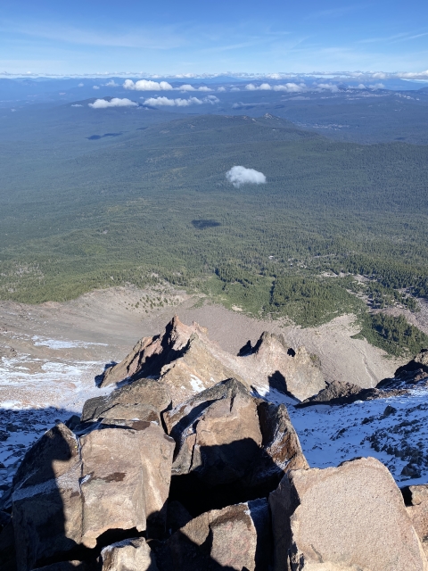
Mount McLoughlin has a large summit area with two competing high points. This is a busy trail and there was little solitude up here. However, that didn’t matter once you start viewing the terrain around you. Views extend over 100 miles giving a great birds eye view of Southern Oregon and Northern California.

Mount McLoughlin summit.
Some of the notable peaks see are Mount Shasta, Mount Scott, South Sister, Mount Thielsen, Mount Eddy, and Preston Peak.
The northwest face drops right out from under your feet and was still holding snow in October.

View down the NW side.
Every sign in the area is very adamant about returning the way you came. There is a nice sandy descent down the southside, however, this leads you far away from the trail and has gotten hikers lost. Return down the same ridge you ascended.

Looking down at the ridge used to ascend.
The Final Word
Climbing volcanoes has a cool ring to it and this is a great non-technical hike. The trail signs say the summit is 5.5 miles, however, my watch calculated 4.8 and a roundtrip of 9.8 miles instead of 11.
While there are many great summits, climbing Mount McLoughlin should be on everyone’s list. I highly recommend tackling this summit. The trail is not as hard as it sounds, especially if you are in good shape. Even if you aren’t, the views from the summit are worth the struggle!