Silver Peak

Place Name: Placer County
Place Description: State: California
Date: 10/21/2022
Elevation: 8,930 feet
Prominence: 210 Feet
Miles: 16.7
Elevation Gain: 4,412 Feet
Lists: Tahoe Ogul
-
Difficulty
-
Solitude
-
Kid Friendly
-
Summit Views
Part Of The 4-Ogul Traverse
Silver Peak is an Ogul List peak in the Crystal Range and can be climbed individually or as part of the traverse. It is located between Red Peak and McConnell Peak.
Overall
2.8Pros
- Minimal bushwhacking
- Short climb
- Nice views
Cons
- Part of a traverse
- Long hike
- Could be hot in summer
While traversing the Crystal Range, Silver Peak mostly hides in plain sight. It’s lower than McConnell and Red Peak, sitting in between them. Unless you are in the saddle on either side of Silver, the view of it mostly just blends in with its higher neighbors.
With a spot on the Ogul Peak List, Silver Peak is generally climbed with the other 3 peaks on the list in one outing.
Getting There
Accessing this section of the Desolation Wilderness is from Ice House Rd. and Highway 50.
Turn onto Ice House Rd which is located between Pollock Pines and Kyburz. This road is a revalue two lane paved road and goes quite aways back in. Follow it for 21 miles and turn right onto Forest Road 36 towards the Tells Creek Equestrian Center. Road 36 goes about 6 miles before hitting the locked gate and parking area. This road is paved, and surprisingly good pavement. Plan on 35-45 minutes from Highway 50 to the Trailhead.
The Trail
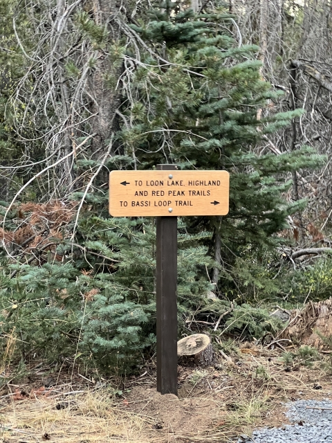
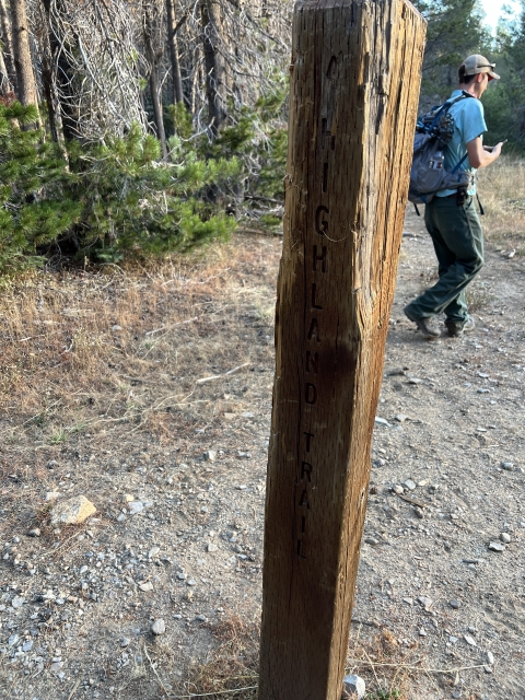
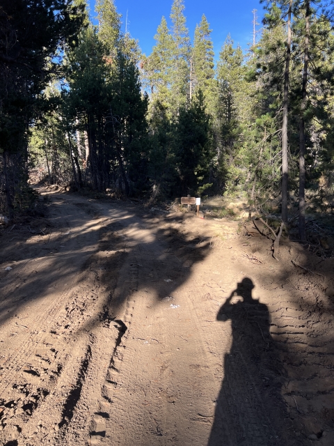
Starting at the parking area, follow the road past the locked gate and for close to a mile. There is a signed junction showing the Highland Trail to the left and the Red Peak Trail to the right. If you are going to Tells first, you will turn left and at the end of the day you will loop back to this very spot.

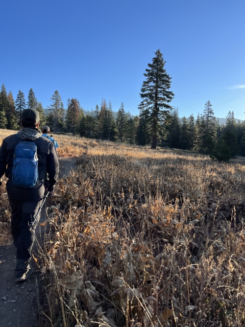
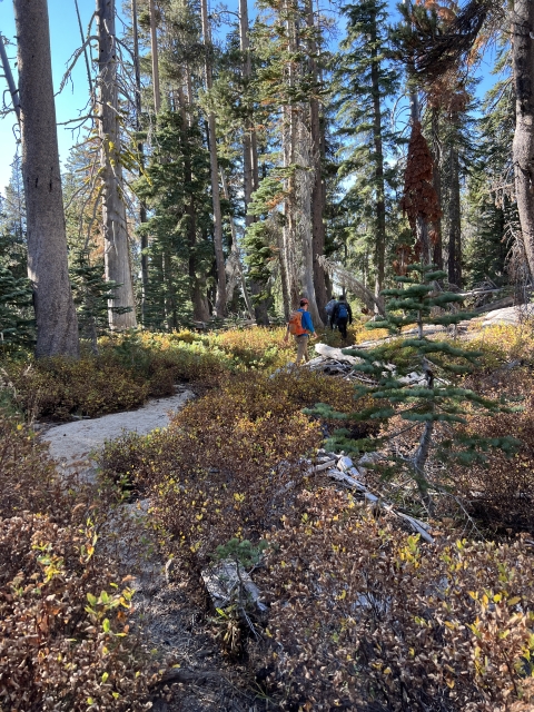
The trail eventually turns into single track and remains pretty mellow for a distance. Soon you will come up to large manzanita covered hill and it will start climbing and switchbacking up towards Forni Lake.

Along the Highland Trail.
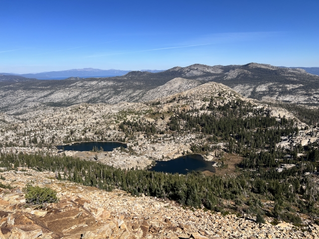
When you arrive at Forni Lake, Tells Peak is straight ahead and can be reflecting into the waters. Follow the trail around the lake and then up the drainage towards the pass.

At the ridge, Tells Peak is to the left, McConnell to the right and Highland Lake below.

Highland Lake and McConnell
Turn left and follow the sporadic use trail all the way to the summit. The register is located on top of the second high point.
Tells Peak
Tells has some nice views overlooking the Desolation Wilderness. Lake Tahoe can be seen along with other Ogul Peaks like Mount Rose and Twin Peaks to name a few.

Lake Tahoe from Tells Peak
After leaving the summit, head back to the saddle and start working your way towards McConnell Peak
McConnell Peak
Next up is McConnell Peak and easily the worst part of the day. The ridgeline is slow going with lots of class 2 and 3 making it hard to stay on it. If you come off the ridge, nasty bushwhacking awaits. The other option is to drop 200 feet below and follow easier ground. Even though it’s easier, there is still some bushwhacking and scrambling to be done.


Once you climb back up to the ridge, the terrain opens up and there is a nice class 2+ summit block to climb up to. The views are similar to that of Tells, except towards the south where you can now see Red Mountain and Mount Price further on.

About 1/2-mile past McConnell Peak is another peak called McConnell Spur. The traverse takes you right over the top and in some circles this slightly higher summit is considered the Ogul.

McConnell Spur
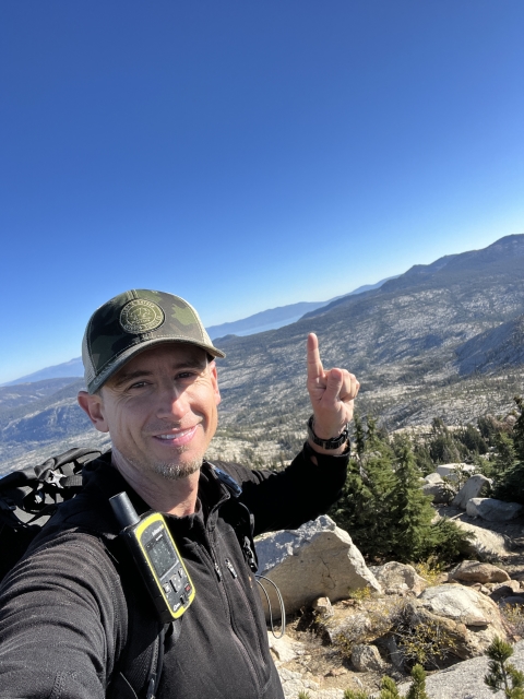
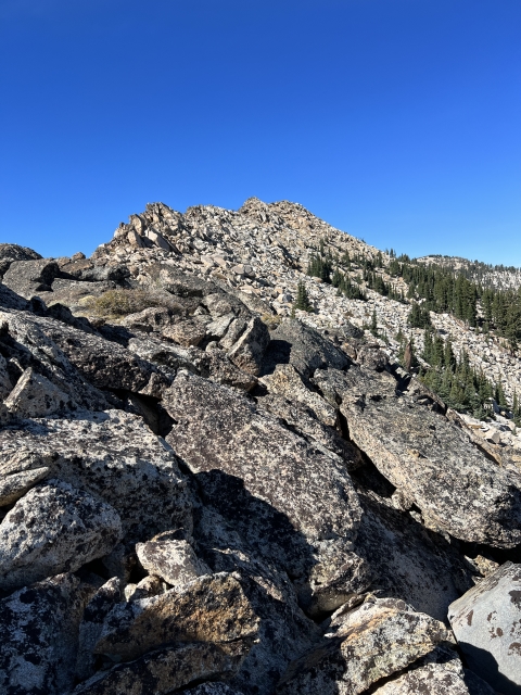
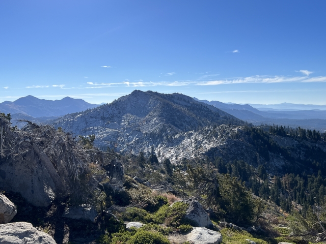
Silver Peak
After the McConnell’s, Silver Peak looms ahead of you. Until now, Silver has kind of been hiding in the foreground of Red Peak. The route over to Silver involves a little tiny section of easy bushwhacking and then some simple scrambling along the saddle. As you reach the final climb, there is a pretty tarn off to the left.

Some easy class 2 climbing brings the summit into reach and just like that, 3 Oguls are in the bag!

Ascending Silver
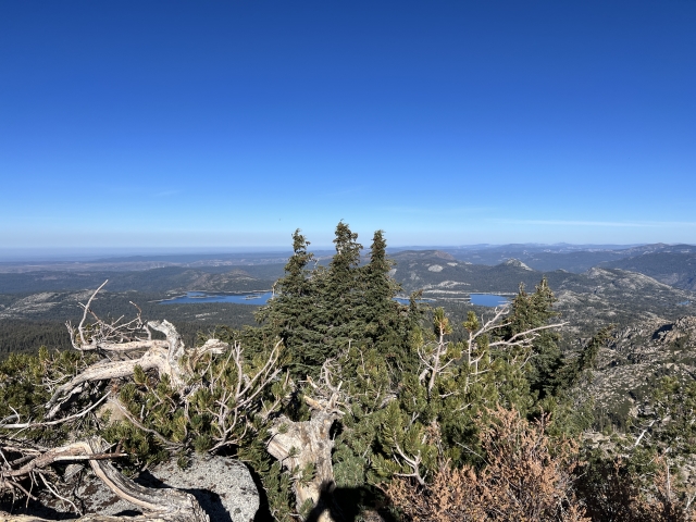
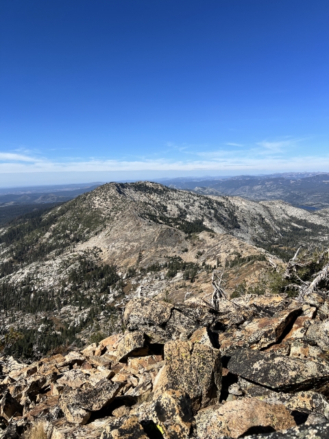
The views are similar as the other summits, however, the entire traverse over to Red Peak is now visible.

Red Peak
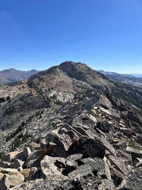
Even though you have bagged four peaks to this point, the highest and the best one is still to come. The traverse over to Red Peak is really fun. Using a nice ridgeline with easy to moderate scrambling through the saddle. A small tarn sits to the right and Lake No. 3 is down below.

Tarn off to right
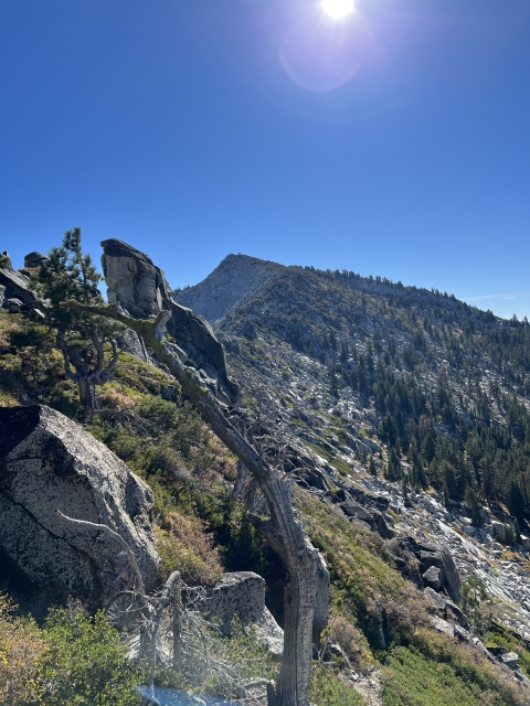
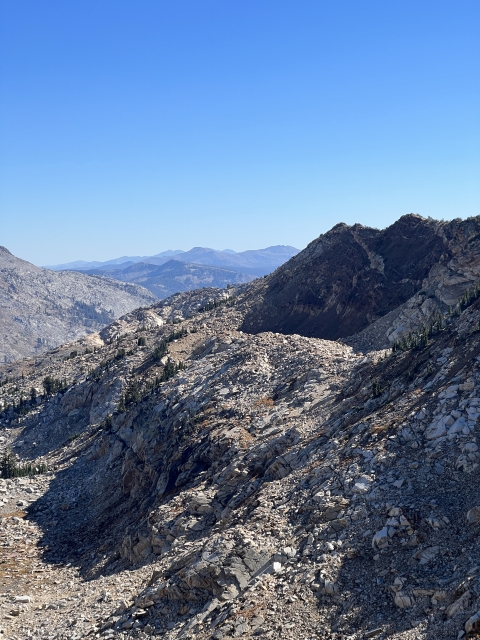
Once you reach the end of the saddle, it’s time to climb. There is some nasty bush right along the ridge to the summit block, making the sandy chute to the right of it the preferable choice.

Ridge towards Red

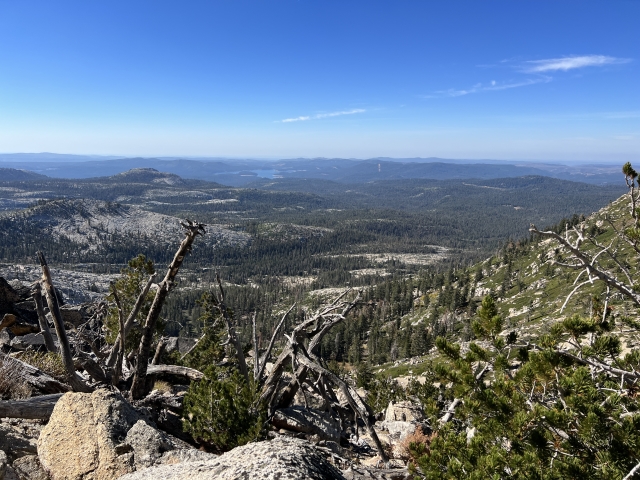
Despite the sandy climb, it’s very short and you are soon working up stable talus to the summit.


The view over towards Dicks and Jacks Peaks are fantastic!

Dicks and Jacks Peak
The Final Word
After all of the summits are in the bag, the easiest way back is to descend Red down to Lake No. 3. From here, hike out on a very nice trail. This is the Red Peak Trail and it leads all the way back to the earlier fork with the Highland Trail.

Lake No. 3
The Red Peak Trail drops gradually over the next 6 miles and is easy to follow and well maintained. It’s an absolute cruiser and a fantastic way to close out a long day of bagging peaks!