Wood Benchmark

Place Name: Oneida County
Place Description: State: Idaho
Date: 08/13/2022
Elevation: 7,760 Feet
Prominence: 2,360 Feet
Miles: 3.9
Elevation Gain: 1,017 Feet
Lists: Great Basin Peak List, Idaho P2K
-
Difficulty
-
Solitude
-
Kid Friendly
-
Summit Views
Off The Beaten Path
Wood Benchmark, also known as Samaria Mountain, is located just inside the Idaho border near Malad City. This range is made up of rolling and grassy hills with some pockets of timber. Although there aren’t many reasons to visit this peak, its spot on the Great Basin Peak List makes it one worth checking out.
Overall
3Pros
- Good access road
- Great views
- Great Basin List
Cons
- Burned up
- Not much else out this way
- Would be hot in summer
If you are chasing the Great Basin Peak List, you will notice Wood Benchmark. In regard to the list, it’s the furthest peak to the northwest. Geographically it may be technically in the Great Basin, however, it seems so far away.
Also known as Samaria Mountain, this Idaho summit probably doesn’t receive many visitors.
Getting There
This one is way out there. It’s near the town of Woodruff and Malad City, two small towns just north of the Utah border along I-15.
Coming from Salt Lake, you will take the Woodruff exit which has a gas station and some ranches. It’s the first Idaho exit.
After crossing back under the highway, you will weave through some ranch land as you head towards the Samaria Mountains. After the last ranch, there is a sign talking about the range and the outdoor recreation you can find. This road is Gardner Canyon Rd. It’s all dirt and can be narrow in places.

Entering Gardner Canyon RD.
Although its dirt, high clearance is only needed in a couple spots, however, it could easily turn into a mud slick after a good rain.
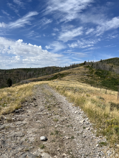
The road can be driven to within 1/2 mile of the summit, or you can park shorter and make a nice little road walk of varying length. If you’ve driven 3 miles, you can drive all of the way to near the summit. The only issues you would have is running into an oncoming vehicle on the one lane road. One saving Grace is that you can see most of the narrow section of road and would be able to wait out another car.

Gardner Canyon Rd
The Hike
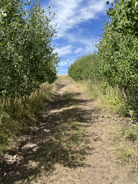
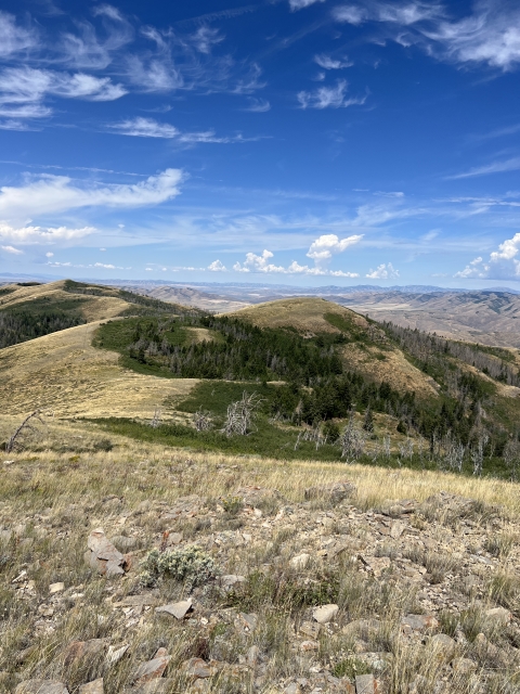
For the most part, just hike the road. Unfortunately, this area burned in 2013 and most of it has not come back. There are some young aspens in places and some older pines on hill sides that survived. In the summer, the grass is very yellow.

The range is more of rolling hills than peaks and there is some very tall grass in places when you cut off trail.
The crux of this hike is jumping a barbed wire fence, so that tells you how easy it is.

The Summit
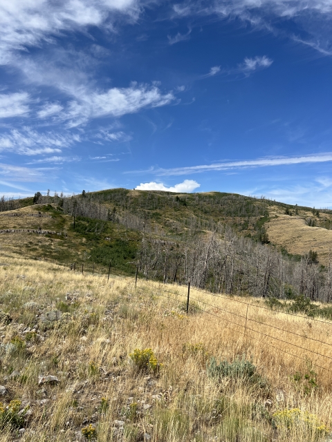
There are two summits. The first one had a little stick above a rocky ridge line. While this one appeared taller by sight, the Wood Benchmark is the next hill a short distance away.

Looking towards the true summit with the benchmark.
While walking through this section, look for fossils in the rocks. There were a few snail fossils to be found.

Fossils
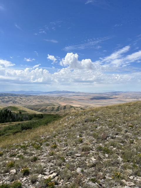
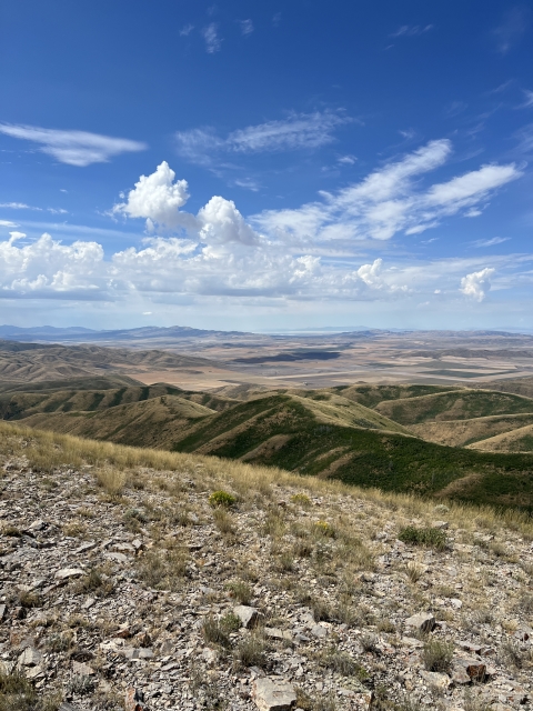
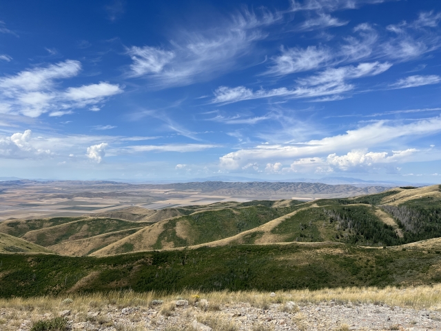
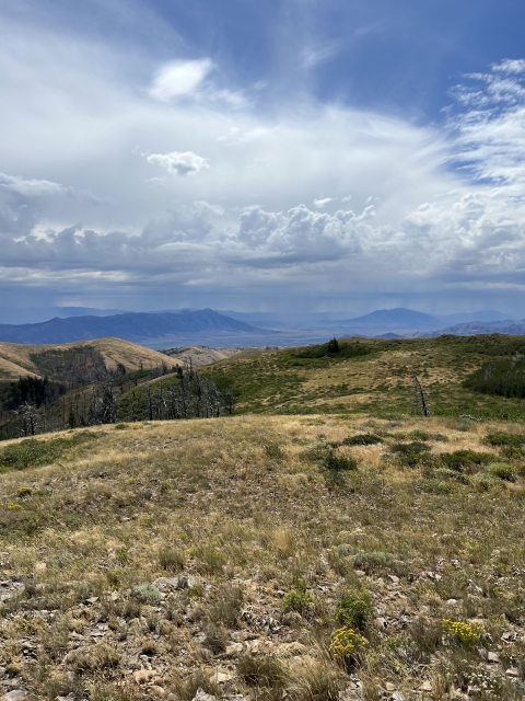
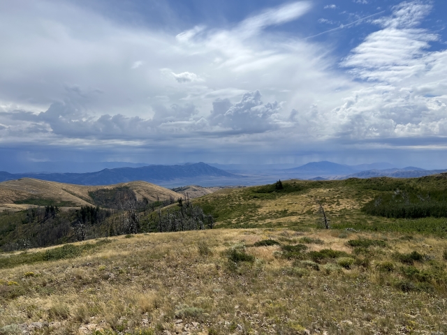
Even though the peak is not super exciting, the views are actually splendid. The green valleys around Malad City are to the north. Bull Mountain and Black Pine Mountain are off to the west, and the Great Basin is to the south.

Even the northern end of the Wasatch Range is visible, however, you can’t see down towards Mount Timpanogos.
The Final Word
Even though the views are nice, this is a peak that is only worth climbing if you are chasing the Great Basin List or Idaho P2Ks.
It’s a long way from anywhere and if you are out this way, it’s way easier to find nicer peaks I. Idaho or Utah. That’s a guarantee!