Anderson Peak

Place Name: Placer County
Place Description: State: California
Date: 08/02/2020
Elevation: 8,683 Feet
Prominence: 163 Feet
Miles: 12
Elevation Gain: 1,700 Feet
Lists: Tahoe-Ogul
-
Difficulty
-
Solitude
-
Kid Friendly
-
Summit Views
A Fun Hike Along The PCT
While there are multiple ways to reach Tinker Knob, a long leisurely stroll along the PCT from Donner Pass is a fantastic way to go. Along the way, you can bag a fellow Ogul Lister, Anderson Peak.
Overall
2.6Pros
- Two Oguls for the price of one
- Nice trail
- Great views throughout hike
Cons
- Talus climb
- Lots of people
- Very exposed ridge. Bring sunscreen.
A couple of the cooler mountains that can be seen from Donner Pass are Tinker Knob and Anderson Peak. This volcanic plug stands just shy of 9,000 feet and can be seen as beacon from all around. There are multiple routes to this isolated summit. We started our hike from the Sugar Bowl Ski Resort on Donner Pass. Starting your hike from this trail head will also take you past another Ogul List mountain – Anderson Peak.
The Trail
After parking at the Pacific Crest Trail Head on Donner Pass Rd, we quickly gained a ridge with multiple switchbacks. Once to this point, the PCT gradually climbs and works its way through the forest underneath Mt. Judah.
Mt. Judah is part of the resort and you will cross under ski lifts before reaching Roller Pass. There is a loop trail that goes up and over Mt. Judah. Make sure to read the interpretive sign at Roller Pass. It’s crazy to see what the settlers did over a century ago.
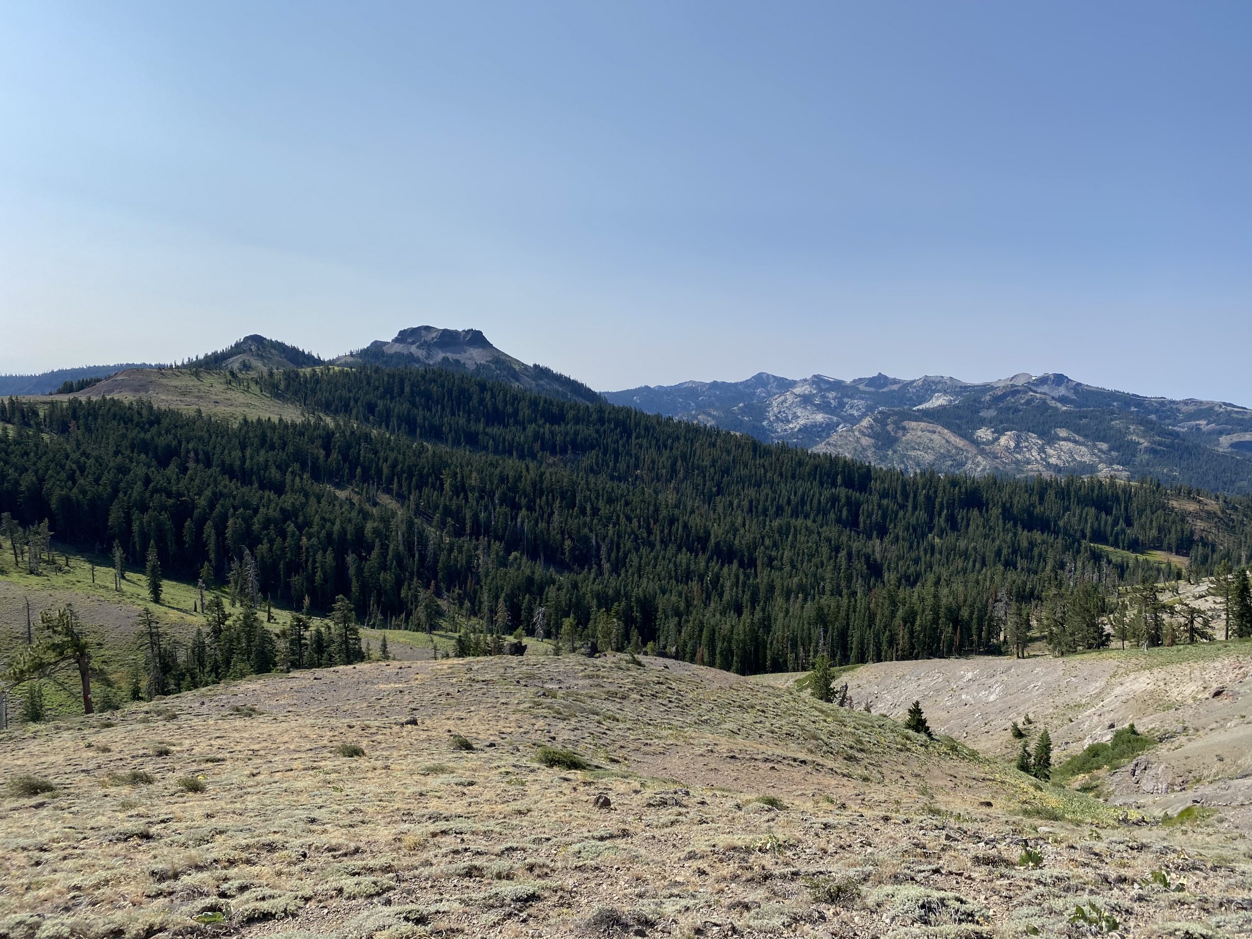
Shortly after Roller Pass, the PCT really opens up along the ridge. There are no trees for a long time and you will be heavily exposed to the sun and wind. Also keep this in mind should thunder clouds start showing up.

The PCT along the ridge.
By now, Anderson Peak is dominating the views to the south. It has very broad summit and looks both steep and loose on its north side. The Benson Hut is located below this side. While I had data that showed this side could be climbed, I also had data that showed coming from the south was much easier. More on that later.
Tinker Knob
We followed around the rocky flank of Anderson and spooked a large coyote. After making a huge loop around the peak, we could finally see Tinker Knob, about a mile away.

Coming around the west side of Anderson Peak.

First views of Tinker Knob.
Tinker Knob now dominates the views to the south and the trail follows the ridge right to it. There is a spur trail that leads off the PCT and goes up through the rock. This trail is class 2. I guess you could goof around on some class 3 as well if you felt like it.
The summit block is very big and lots of space. The views are fantastic in all directions. You can view so many Ogul Peaks, including the cool looking traverse of Granite Chief, Needle Peak, and Lyon Peak just across the canyon. Lake Tahoe can be seen to the east. To the north is a direct view of the Sierra Buttes and English Mountain. As of this report, there is no summit register. The mileage to Tinker Knob was just under 8 miles.

Looking across the canyon at the Granite Chief Wilderness.
Anderson Peak
Now that Tinker Knob was in the bag, we set our sights on the south side of Anderson Peak. The south flanks looked much easier to climb. We left the PCT before it started to drop and followed the open ridge to the band of cliffs on Anderson’s east side.

The eastern face of Anderson Peak.
This is a short hike to the top across some very stable talus. I didn’t have much move on me at all. The summit is very big and the high point is on the eastern side if it. You can see an old steel register box sitting on a rock.

Heading up the south side of Anderson Peak.
Again, we were treated to wonderful views. Castle Peak looked very cool to the north. Inside the register box there is an old 1926 drivers license!
We considered dropping down the north side back to the PCT, however, I found that too steep and loose to take my son on. We doubled back the way we came and came back around the west side of Anderson. If one were going for Anderson alone, the round trip total would be around 12 miles.
Mount Lincoln
One of the nice things about this hike is there are multiple bonus peaks. The bad thing is they are in Sugar Bowl and inundated with ski equipment and junk.
As the PCT climbs towards Mount Lincoln, you gain over half the mountain. From there, a steep spur trail leads up the summit and makes an easy add on. We followed a short ski run down to a use trail and connected back to the PCT. This side trip adds on only 1/2 mile or so.

Mount Lincoln
Since it was getting later in the day, we decided to abandon the idea of doing the Mt. Judah loop. If we really want to do that peak someday, it’s not very far from the parking lot.
The Final Word
This was a wonderful hike. The trail does see a lot of visitors, mostly backpackers and trail runners, however, it never felt crowded. The best part of this being able to bag two Oguls and up to three bonus peaks, making it a great day’s effort.
Tinker Knob is definitely closer to bag from Squaw Valley, although, coming from Sugar Bowl is a closer drive for those coming from the valley and easier walking.
All in all, I’d recommend this as a long moderate day hike if you are in good shape. The terrain isn’t difficult and the views are gorgeous!