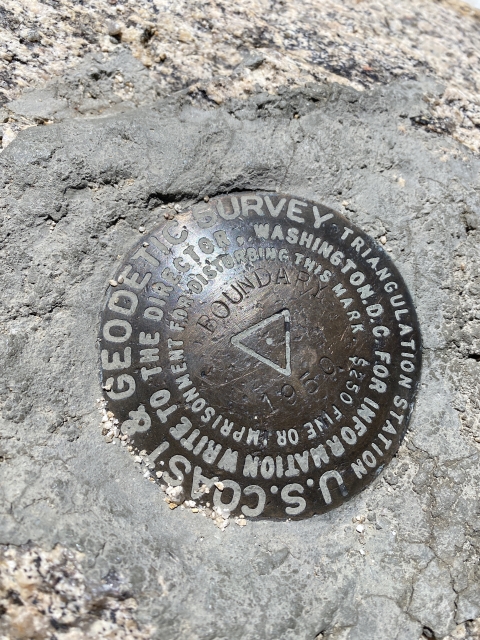
Boundary Peak

Place Name: Esmeralda County
Place Description: State: Nevada
Date: 5/30/2021
Elevation: 13,140 Feet
Prominence: 253 Feet
Miles: 10.8
Elevation Gain: 4,733 Feet
Lists: State High Point, Nevada Peaks Club, Great Basin List, Desert Peaks Section, Desert Summit Book, Las Vegas Mountaineers Classics, Western States Climbers
-
Difficulty
-
Solitude
-
Kid Friendly
-
Summit Views
The Highest Point In Nevada and Its Neighbors
Even though Wheeler Peak in Nevada’s Great Basin National Park is regarded as the highest peak in Nevada, Boundary Peak is the highest point in the state. With less than 300 feet of prominence, it is technically a sub peak of the higher Montgomery Peak just across the saddle in California. That said, Boundary is still an awesome mountain experience and the opportunities to bag other peaks is also part of the day.
Overall
2.9Pros
- Good access road
- Awesome Views
- Wild horses and deer abound
Cons
- Very exposed to the sun
- Long way from anywhere
- Tedious scrambling over to Montgomery Peak
Boundary Peak may be the highest point in Nevada, however, is it actually a peak?
Since it lies on the ridge with California’s Montgomery Peak, Boundary could just be considered a bump. Fortunately for it, the state line crosses the saddle and thousands flock there to tag the Nevada high point.
For those a little more daring, the traverse over to Montgomery Peak is well worth it!
Getting There
Boundary and Montgomery lie on the northern end of the White Mountains. Most people think of the Bristlecone Forest and White Mountain Peak when they think of the whites. These are many miles to the north and nowhere near the famous White Mountain Rd.
Accessing the trailhead to Boundary Peak comes from US-6 just north of Benton. There are two dirt road routes in, Queen Anne Mine and Trail Canyon. We came in from Queen Anne.

The road into Boundary Peak.
The turnoff to Queen Anne is across the street from a boarded up brothel and can drive you up to 9800 feet where it’s wide open and offers great camping. We camped lower at the abandoned mine.

Campsite at Queen Anne Mine
The road in is all dirt and high clearance required. 4×4 is not necessary. The road does worsen above the mine and I would park there if you don’t have high clearance.
Boundary Peak
There is a very nice trail most of the way to Boundary Peak. It switchbacks up through open plains and bristlecones and goes under Trail Canyon Saddle Peak all the way to Trail Canyon Saddle. During this stretch we saw quite a few wild horses.

Wild horses.
After the saddle, the real climbing begins. The trail snakes up through the talus and gains a ridge at 12,000 feet just below Hosebag Peak (a sub peak of Boundary).
Boundary Peak is now in full view and the route is pretty obvious. Follow the ridge to the left. The trail disappears here and it’s easy to get sucked down too low. Coming back, I stayed as high on the ridge as possible and it was much easier.

View of Boundary Peak after gaining the first ridge above 12,000 feet.
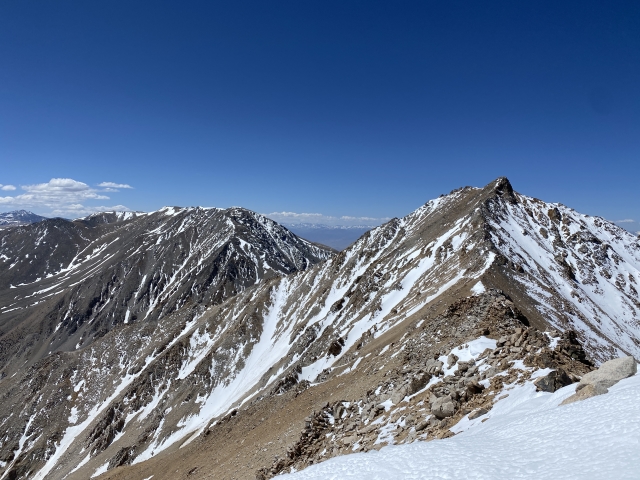
After the last 1000 feet up the ridge, you will be standing on the highest spot in Nevada and enjoying the amazing views. To the north, only .75 miles away lies Montgomery Peak and man does it look inviting!

Looking at the traverse over to Montgomery Peak.
Montgomery Peak
Montgomery Peak is a big get for peak baggers with spots on multiple lists including the Great Basin Peak List and Desert Peak Section.
The terrain across the saddle borders on class 2 to class 3 depending on which way you climb and snow conditions. It’s very slow going and took 4 of us who are very strong hikers and hour each way. We did encounter some class 3+ at times and some slight exposure where a slip could be very painful.

Working the ridge over to Montgomery Peak.
The summit block was very cool and an easy class 2 climb to the top. The views are astonishing.

The final summit block of Montgomery Peak.
Trail Canyon Saddle Peak
On the return, we added some extra gain going over the summit of Trail Canyon Saddle Peak. This is a nice peak of its own and falls on the Andy Zdon Desert Peaks List.

On the summit of Trail Canyon Saddle Peak.
The terrain is completely open with exception of some bristlecone pine trees. Tacking on this peak tacks on very little extra mileage since you are basically just following the trail, just higher.
The Final Word
Boundary Peak is not easy, but it’s not super hard either. For a western state high point, it’s straight forward. Just remember there is no water and you are very exposed the entire day and at highway elevation. So be weary of approaching weather and forecasts. It will be a long day too, especially if you add on the bonus peaks.
The day was very rewarding and checked off a lot of boxes for me. I was pretty exhausted by the end of it, however, I thoroughly enjoyed it!