Desert Creek Peak

Place Name: Lyon County
Place Description: State: Nevada
Date: 12/15/2020
Elevation: 8,958 Feet
Prominence: 1,660 Feet
Miles: 5.8
Elevation Gain: 2,805 Feet
Lists: Tahoe-Ogul, Desert Summits Book
-
Difficulty
-
Solitude
-
Kid Friendly
-
Summit Views
The Ogul List Peak With A Nasty Reputation
Desert Creek Peak gets a bad reputation in the peak bagging community. Known for nasty brush, loose rocks, snakes, and steepness will get you that. Looking at some of the routes up this mountain I can see why. Fortunately on my trip, steepness was the only of these we really encountered.
Overall
3.1Pros
- Good access road
- Great views
- Lots of peace and quiet
Cons
- Brushy
- Steep
- Communication tower on summit
Desert Creek Peak located in Nevada has little to do with Lake Tahoe. In fact, it has nothing to do with Lake Tahoe. I can only assume it’s inclusion on the Tahoe-Ogul List was some kind of joke that the organizers were trying to play on future explorers.
I was thinking about using this peak to finish the 63-peak list. However, some low snow and a nice weather window gave us the perfect conditions to tag this in December.
Getting There
Getting to Desert Creek is pretty straight forward. Get onto NV-338 and head just south of Wellington, NV and make a right on the dirt Desert Creek Rd.

Start of the road into Desert Creek Peak.
This is a high speed dirt road for the first few miles before turning into a slower rockier road. It’s all 2WD. The main obstacles are the 4-5 crossings of Desert Creek. These may present a problem during the spring.
On this December day, we made it through the first one which was wide and shallow. The next 3-4 were frozen solid so we decided to park here. This spot is before the campground and requires walking an extra 1.1 miles of the road each direction.

Frozen creek crossing.
Keep in mind, you can also access this peak from a dirt road further down on NV-338. This is Risue Rd and is the road used to access the start of the East Sister and Middle Sister traverse.
The Trail
The first rule of Desert Creek Peak is there is no trail. You have 2,600 feet to climb in 1.75 miles. This peak is known for thick brush, steep loose rock, and rattlesnakes. This is the reason we had targeted this as more of a winter/early spring hike. With the snow cover and cool temps, we wouldn’t have to worry about snakes at all. Dealing with brush and rock is that much easier when you don’t have reptiles to contend with.
After passing the very nice campground, we turned off to the left following Bo Meng’s track from PeakBagger. I have to say that this was a very good route. The bushwhacking was minimal and I kept waiting for it to get worse, but it never did. Not even half as bad the descent from East Sister to Middle Sister.
The loose rock seemed to be held in place by the snow and ice and never really found myself slipping much.

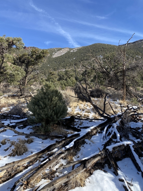
Headed up.
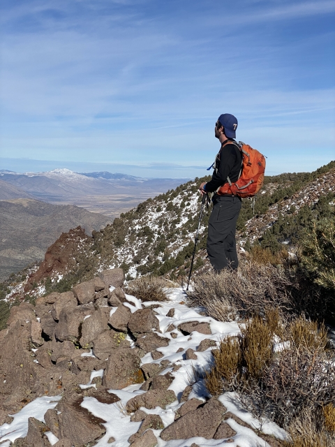
Once we topped out the ridge, the brush thickened, however, still very passable. Even found a set of bear tracks in the snow up here. Looking at the ridge back towards Black Mountain looked very thick and nasty. I know others have ascended this peak from that direction and that doesn’t look like any fun.
The Summit
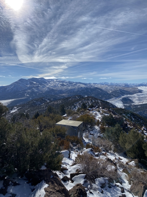
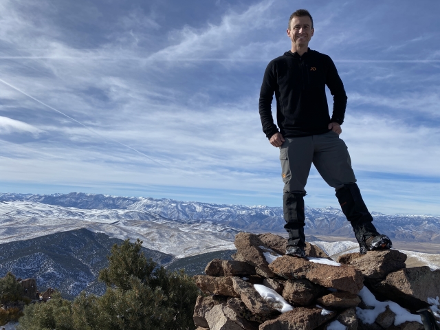
There is a very large rock summit cairn that makes up the summit and a strange benchmark. The California Department of Transportation put it in. There was no summit register.

Desert Creek Peak summit cairn.
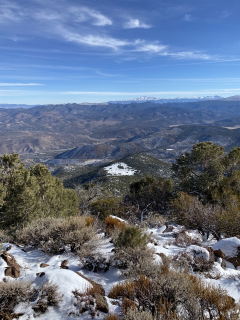
Views are pretty fantastic of the surrounding area with notable peaks visible in all directions. Looking back down to Desert Creek Rd. was humbling and shows just how steep our ascent was. There is also some radio equipment and a large metal box up here.

Summit views
The Final Word
I’m glad to have tagged this peak but would probably not do it again. The country is rugged and the views are nice, however, I would not call this a fun peak.
The best bet is to hike this in conditions like we did. This area would be very hot and dry in the summer and snakes would be an issue as well. Catching this with a foot of snow on the ground and consistent snow cover over the rocks is optimal.
I’d recommend hiking this between November and early April depending on snow conditions. With 40 Oguls completed at the of 2020, it’s now time to focus on trying to complete the list in 2021!