Gass Peak

Place Name: Clark County
Place Description: State: Nevada
Date: 10/30/2021
Elevation: 6,943 Feet
Prominence: 2,023 Feet
Miles: 6.7
Elevation Gain: 2,133 Feet
Lists: Desert Summits Book, Nevada P2K
-
Difficulty
-
Solitude
-
Kid Friendly
-
Summit Views
The Guardian of North Las Vegas
Gass Peak towers over north Las Vegas and can be seen from anywhere in the city. Theoretically, this could be climbed from the outskirts of Vegas, but the easiest access is by driving deep into the Desert National Wildlife Refuge,
Overall
3.3Pros
- Good access road
- Easy trail
- Beautiful desert
Cons
- Long drive out on dirt roads
- Would be hot in summer
- Comms towers on summit
Standing over North Las Vegas like a guardian, Gass Peak is seen daily by millions that call the Vegas Valley home. If you are to take a poll however, the majority of people could not point this mountain out.
Gass Peak is very visible from anywhere in the city and offers the desert wanderer a true desert experience.
Getting There
Firstly, take Corn Creek Rd off of US-95 north of Las Vegas. Follow the pavement to where it dead ends at the Desert Wildlife Refuge visitor center. Secondly, hang a right on Alamo Rd and then a quick left on Mormon Well Rd.
Despite being dirt and bumpy, high clearance and 4WD, however, are not required. Take Mormon Well Rd. for four miles and lastly, hang a right onto Gass Peak Rd.

Gass Peak turnoff
This road is about the same as Mormon Well and can be driven at 20-30mph. Drive this road around 8 miles to the Gass Peak TH sign.

Gass Peak TH
The Trail
The summit can be seen from the very beginning and the trail starts as an extension of the road. A short ways up there is fork. The left is more of a single track trail and the right is a road. They eventually meet on ridge at 5500 feet.

Where the trail splits.
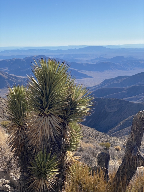
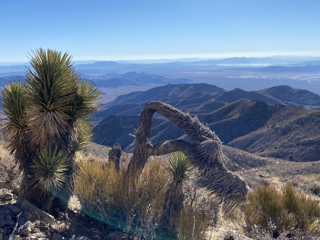
Moreover, from this point on the trail is well maintained and easy to follow as it follows a series of little ridges and bumps working south towards the main ridge. Enjoy the cactus and Joshua Trees as you hike through the desert.

Morning sun coming through the Joshua Trees.
Approximately 2.5 miles in, you will reach the main ridge line at 6,300 feet and follow this all the way to the summit.
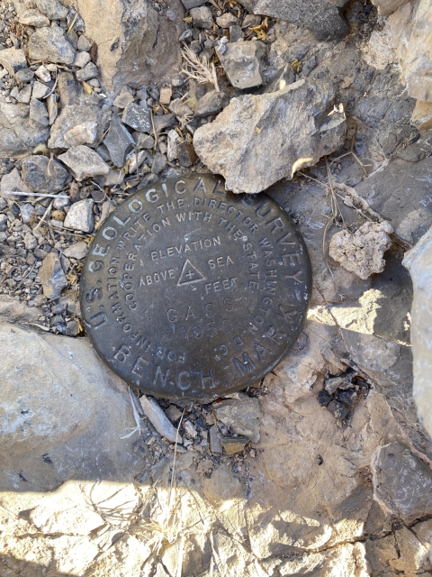
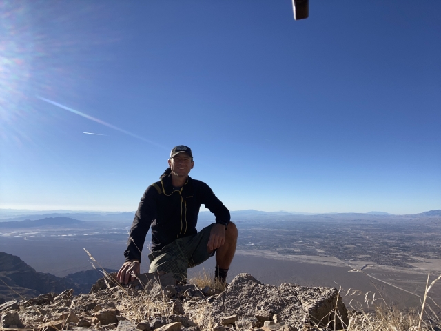
The Summit
Sadly, this summit is covered with radio communication equipment. Please don’t let that detract from the views. One can argue that these are the best views of Vegas you can see with two feet on the ground.
Lake Mead is very visible as is Clark Mountain, Virgin Mountain, Mount Charleston, and Hayford Peak.

View of Las Vegas.

Views of the Sheep Range.
Even though the Clark County shooting range sits about 4,500 feet below the summit and the sounds of gunfire can be heard with ease. This doesn’t bother me much, although it takes away from the solitude a bit.
The Final Word
Gass Peak is a true desert hike. Some might say the terrain is bland, however, I feel it’s quite beautiful. Even though it really isn’t far from the city, getting there feels like you are worlds away from it.
The trail is well maintained and easy to follow. and it’s even engineered to negate the unnecessary gain on the return. I’m rating this as a beginner’s trail.

Gass Peak Trail climbing.
Gass Peak does receive snow at times, although you can climb it year round. It will be a real scorcher to hike out here in the summer. I have also seen some amazing night pictures from the summit. I can only assume a night hike would be amazing.
In conclusion, if you like the desert, I highly recommend hiking to the summit of Gass Peak.