Hayford Peak

Place Name: Clark County
Place Description: State: Nevada
Date: 10/27/2021
Elevation: 9,912 Feet
Prominence: 5,392 Feet
Miles: 16.4
Elevation Gain: 4,244 Feet
Lists: Great Basin Peaks List, Desert Peaks Section, Ultras of the Lower 48, Desert Summits Book Peak List, Nevada Peaks Club, Las Vegas Mountaineers Classic
-
Difficulty
-
Solitude
-
Kid Friendly
-
Summit Views
A Hidden Ultra
Despite its status as an ultra and proximity to Mount Charleston, Hayford Peak is very unassuming and flies under the radar in the area. With a cool name like the Hidden Forest TH, getting to the summit is a fun and rewarding experience.
Overall
3.5Pros
- Good access road
- Awesome cabin and history
- Lots of peace and quiet
Cons
- Long drive out on dirt roads
- Would be hot in summer
- Comms towers on summit
As far as Ultras go, Hayford Peak is very unassuming. With a location just north of Vegas, the summit can be seen sticking out as the high point of the Sheep Range from most of the city. Despite this, most folks would have no clue where to find this mountain.
Don’t let this fool you. Hayford Peak is located in the Hidden Forest and is a beautiful hike. The trail will start in a Joshua Tree covered desert, lead into a pine forest, and top out at the summit among bristlecone pines.
Getting There
Hayford Peak lies in the Desert Wildlife Refuge north of the city. There is a nice visitor center and network of dirt roads that cross this area.
Take US-95 north out of the city and turn right onto Corn Creek Rd. After you leave the city, this is the 3rd road you will see and comes after the turnoff for Snow Mountain.
Corn Creek Rd. is paved for 4 miles to the visitor center. Pass the buildings and turn left onto Alamo Rd. Follow Alamo Rd. for around 15 miles until you see the sign for Hidden Forest Rd.

Alamo Rd.
Make the turn and head a few miles towards the mountains. The road will end at a large parking area at the Hidden Forest Trailhead.

Hidden Forest TH
These roads are all dirt and bumpy. High clearance and 4WD are not required, however, with a regular car going slower will be needed. In a Tacoma with off-road tires, I was able to cruise between 25-35mph, covering the distance in about 40 minutes.

The Hidden Forest Road.
The Trail
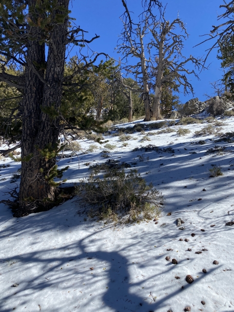
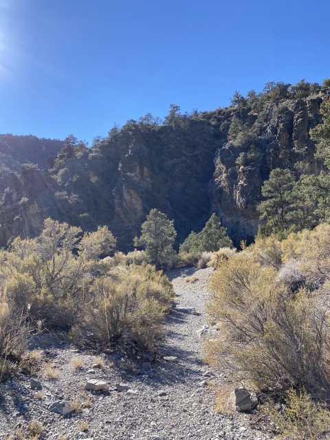
From the parking area walk down to the gate that denotes you are entering Deadman Canyon. Early in the morning this section is shaded which would be nice on a warm day. The canyon starts at 5,800 feet elevation.

Start of the hike into Deadman Canyon.
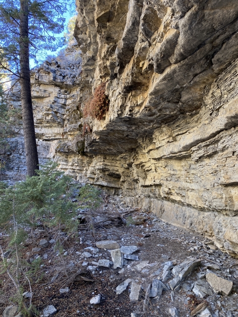
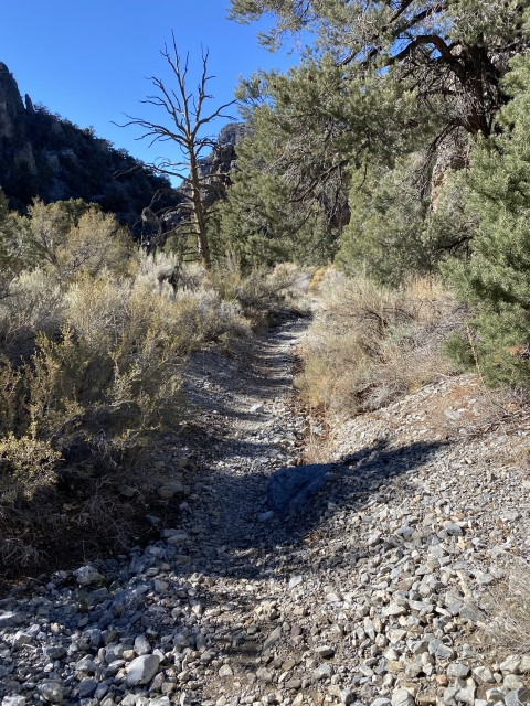
Even though the trail meanders through brush, it is easy to follow through the canyon. Cool rock outcroppings line both sides of the canyon making for a beautiful hike. Although the gain is over 2,000 feet during the first 5 miles, you never really feel like it’s overwhelming.

Cool rock formations.
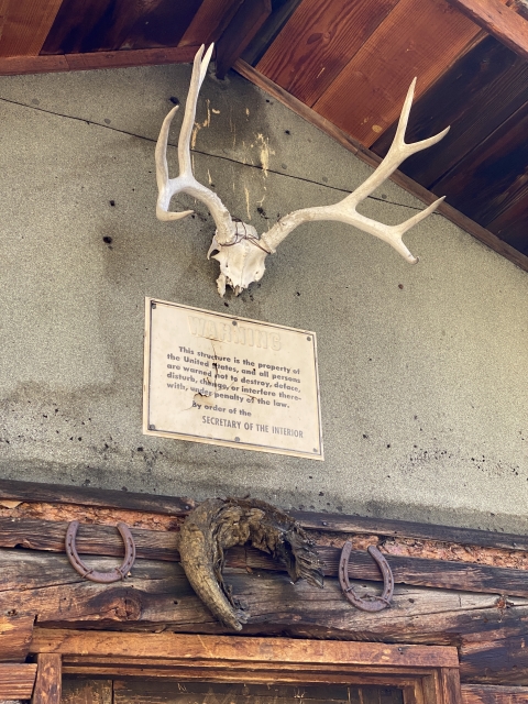
As the elevation gains, the desert terrain dissipates and turns into a pine forest, similar to the landscape you would find on the northern side of the San Gabriel Mountains in Southern California. After 5 miles you will notice a wooden outhouse on the left and a short distance later you will come to a clearing with an old game warden’s cabin that is over 100 years old. There are picnic tables and running water here. Although the peak is the ultimate prize, this would be a nice destination in itself.
This cabin can even be camped in on a first come, first serve basis.

The cabin at the Hidden Forest Trail.

Running spring water at the Hidden Forest Cabin.
From the cabin, follow the drainage to the right. There isn’t much trail here, however, I did see 4-5 blazes in the trees marking the way. Despite the lack of a defined trail, all you need to do is stay in the drainage following the obvious dried creek bed. Just stay in the gully as it climbs to the ridge.

Following the wash.
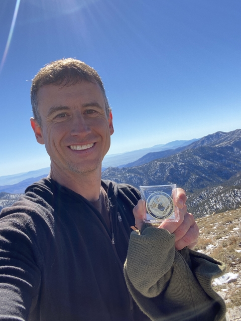
The Summit
Once you gain the ridge, there is a trail that heads off to the right. From this point you are about 900 feet below the summit. The trail here is well defined and is easy enough to follow even with snow on the ground.
Pass by the false summit on the right and you will see the rounded summit come into view.

The summit comes into view.
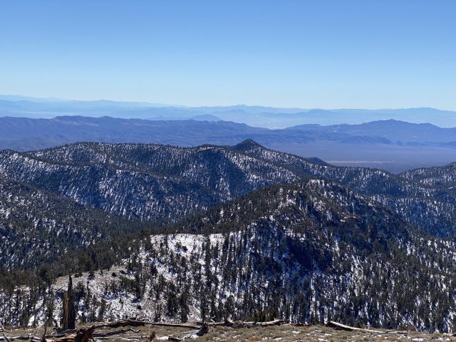
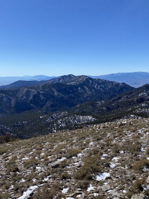
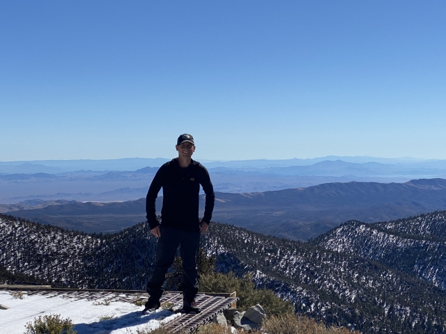
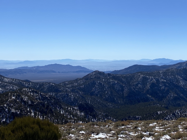
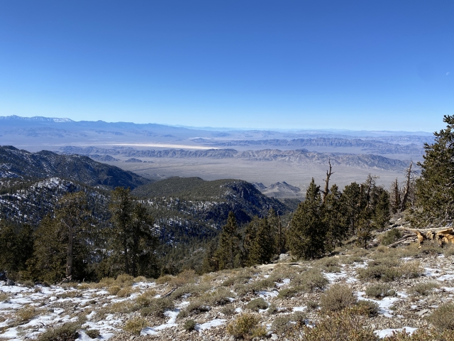
Unfortunately there is comms junk on the summit, although its ugly, the views are something else. Lake Mead can be seen, the Virgin Mountains, Gass Peak, Signal Peak in Utah and all the way to Mount Whitney and the snow capped Sierras. The Spring Mountains with Mount Charleston and Mummy Mountain can be seen across the valley.


View towards Gass Peak.
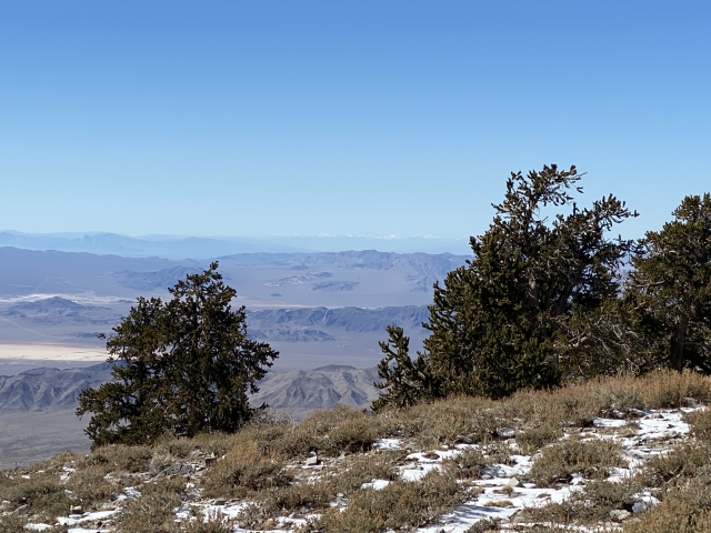
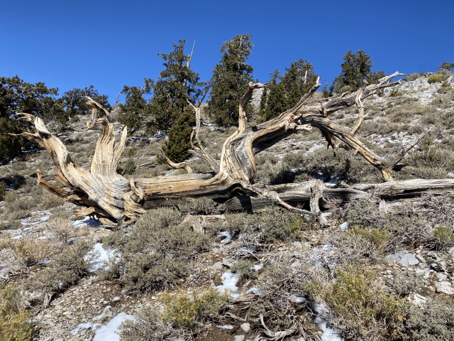
Bristlecones mostly block the views to the north, not a bad thing however.
The Final Word
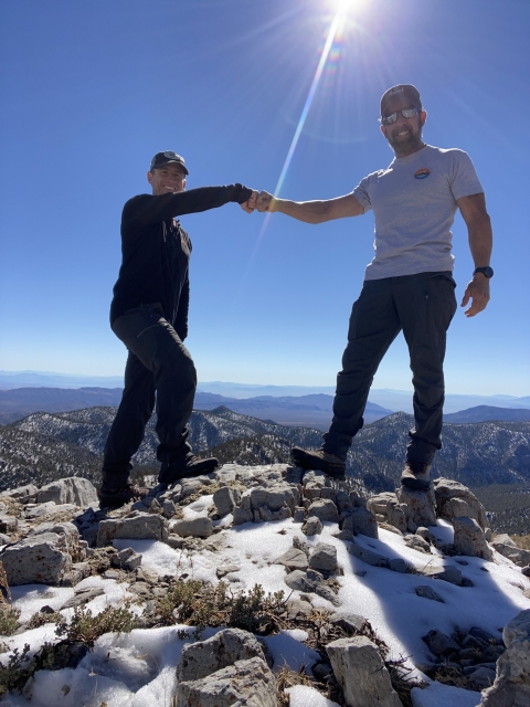
Hayford Peak is a super cool mountain and less traveled trail than most of the other Vegas peaks. While Charleston is an amazing trail, Hayford brings you much more solitude. In fact you probably won’t encounter another person on your trip.
The Desert Wildlife Refuge is fun to check out and explore whether you are hiking, peak bagging, or off-roading. There is a lot of country out here to explore!
Even if you aren’t interested in tagging the summit of Hayford, a hike to the cabin would be a great accomplishment, totaling around 10 miles and 2,000 feet of gain.
Keep in mind, you are a long ways out there, I’d highly recommend packing for the worst. This area gets both brutal heat and bitter cold depending on what season you go. Cell service was good on the drive out and the summit ridge, however, it’s non-existent in the canyon.