Mount Augusta

Place Name: Churchill County
Place Description: State: Nevada
Date: 05/17/2022
Elevation: 9,966 Feet
Prominence: 4,366 Feet
Miles: 10.2
Elevation Gain: 4,564 Feet
Lists: Great Basin Peaks List, Nevada Peaks Club, Western States Climbers Emblem
-
Difficulty
-
Solitude
-
Kid Friendly
-
Summit Views
The Beast Of The Clan Alpines
The Clan Alpine Mountains won’t be the most recognized range in Nevada, especially with the more popular Desatoya Mountains just across the valley. At 9,966 feet, Mount Augusta is an absolute giant in the area and boasts over 4,000 feet of prominence. It’s only 9 feet lower than Desatoya Peak, leaving it within the margin of error to be the actual county high point.
Overall
3.6Pros
- Lots of wild horses
- Great views
- Fighter jets overhead
Cons
- No trails
- Snake country down low
- Would be hot in summer
Lying just north of the Loneliest Road In America, Mount Augusta towers above the surrounding Clan Alpine Range at 9,966 feet. Augusta has a commanding presence over the area and forms quite the tandem with the Desatoya Twins across the valley.
With over 4,000 feet of prominence, Mount Augusta is one of Central Nevada’s top summits.
Getting There
One can gain access to the Clan Alpine Mountains using US-50 about 60 miles east of Fallon. If heading east, you will turn left at a sign onto a road that heads to Alpine.

Road into Mount Augusta.
The majority of climbers use this turnoff and drive up War Canyon to shorten this hike. This report will highlight how to climb Mount Augusta from the longer southeast ridge lines.
Follow Alpine Rd for about 2.6 miles and make the first left you see onto a lesser road. Although the road has rocks, it only requires moderate clearance.

Parking area
You can park as the road enters into Florence Canyon and start working up the ridge to the right.
The Trail
Hiking from this start point is at 6,000 feet elevation, however, it’s over 2,000 feet lower than the other trail head. Take this into account, especially on a hot day!
The first couple of miles climb through a burn zone and is made easier with a dozer line cut into the Earth. The dozer cut will run out around 6,600 feet.

Burn scar
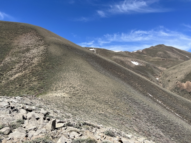
Even though there are no trails, the path is easy to see. Follow one ridge to the next and repeat. After exiting the burn zone, the landscape changes to what the lower half of the mountain would have looked like.
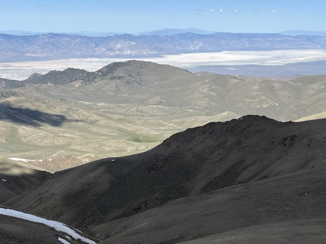
After two steep rocky ridges, the terrain opens up into the alpine. There is large hill that will take you from 8,600 to 9,000 feet. Thankfully, horse trails cut around the side a making things easier.

Wild horses abound in this area. Massive herds were running all over the high plateaus.

More horses.
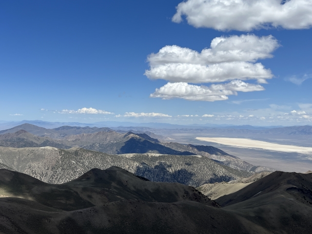
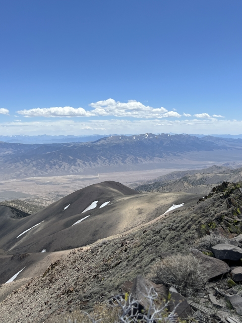
The Summit
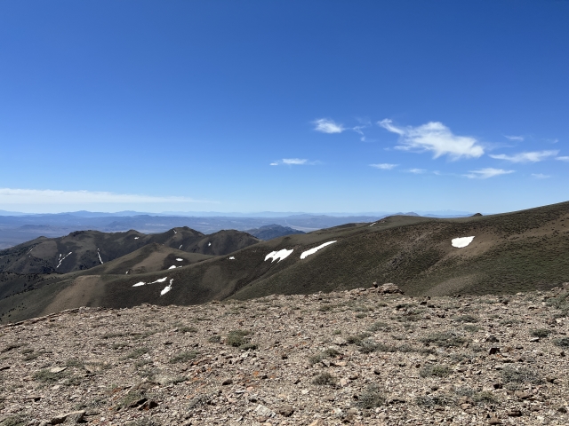
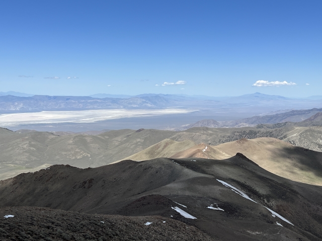
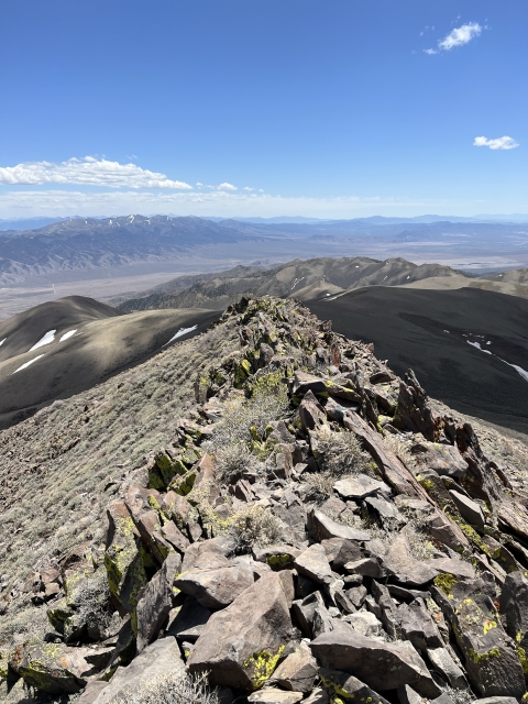
Gaining the final 700 feet is easy going. The summit stands tall and there is a bit of an easy scramble section just at the top. After that, sit back and revel in your accomplishment and soak in the views.

Mount Augusta summit

Summit ridge
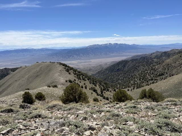
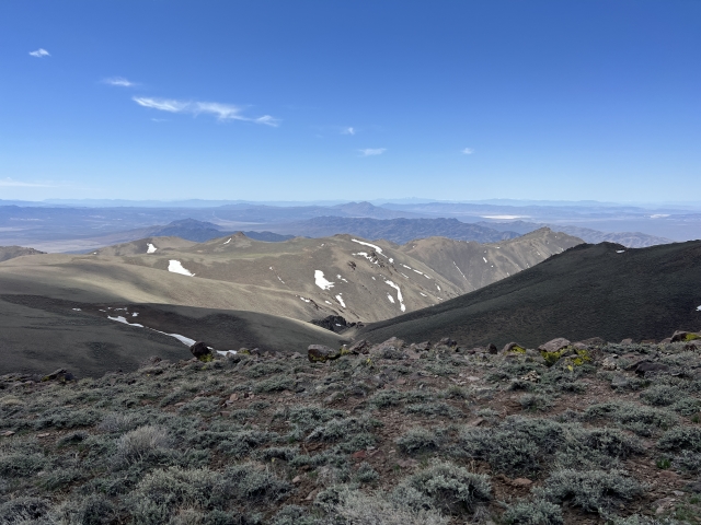
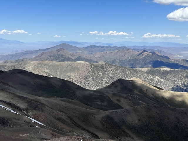
Views from a summit like this are unbelievable. From this perch, you have a birds eye view of the rest of the range. Surrounding peaks like Job Peak, Desatoya Peak, New Pass Peak, and Mount Tobin are all in plain site.

View to north
The Final Word
Even though this route is much longer than the standard route, it’s still a pleasant climb up the ridges. Route finding is straight forward and the occasional horse trail can be used to scoot along.
The Clan Alpines are pretty range and make for a good combo trip with summits on the Desatoya Mountains and Stillwater Mountains.