Mount Fillmore

Place Name: Sierra County
Place Description: State: California
Date: 11/11/2020
Elevation: 7,715 Feet
Prominence: 1,675 Feet
Miles: 3.8
Elevation Gain: 1,259 Feet
Lists: Tahoe-Ogul
-
Difficulty
-
Solitude
-
Kid Friendly
-
Summit Views
Off The Beaten Path
The longest and most tedious part about hiking Mount Fillmore is getting there. This mountain is well off the beaten path of the major Sierra highways. Don’t let that discourage you from making the trip!
Overall
2.9Pros
- Approach road is in good shape
- Pretty country
- Nice cross country hike
Cons
- Short hike
- Long daytrip
- Approach road from the east could be bad
If you aren’t familiar with the Plumas National Forest, Mount Fillmore is more than likely a peak you have never heard of. It only came to my attention since it falls on the Tahoe-Ogul Peak List. In that regard, Mount Fillmore may be known as the easiest peak on that list to summit as well as the most out the way to get to.
Getting There
This is the hardest part. Technically, the roads aren’t hard, they are just so far out of the way. The closest towns are Quincy and La Porte. For me, coming from the central valley, we made our way into Marysville and went east on Highway 20. From here we turned north following mapping software through towns that time has forgotten all the way to La Porte.
The Quincy-La Porte Road is paved heads north connecting to Highway 70.
This road does not get plowed in the winter. Even though we had a snowstorm the week before, the pavement was clear. You will follow this a few miles until the dirt Johnsville-McCrea Rd. forks off to the right.
Johnsville-McCrea Rd. can be accessible from this point or from the east. Coming from the east would be a much longer drive on this road and I’ve heard mixed reports about how good of a road it is. Coming from La Porte, we had snow on the road the entire way, however, it would be 2WD accessible with moderate clearance. There are rocks and it’s bumpy, but nothing hard at all.
The Trail
As expected, there really is no trail to this mountain. The travel is easy and direct traveling through an open pine forest. Like I mentioned earlier, this is a very easy hike and one that could be knocked out in a couple of hours depending on your fitness level.
During our hike, there was snow the entire way. Very soft sugary powder. A couple of areas climbing the hillside we found ourselves postholing, although, this was mitigated with a gentler ridge on the return route.

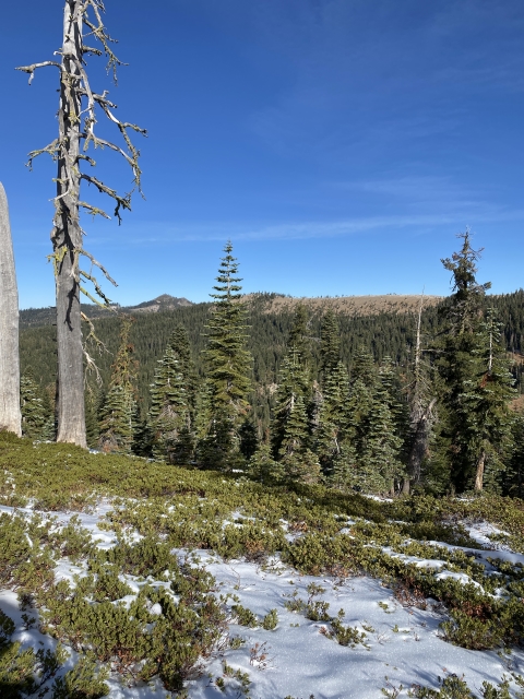
Making our way through the forest
Once out of the trees, there is a wide open ridge to gain and an easy walk to the summit. Mount Fillmore has the big views you would expect from a peak with over 1600 feet of prominence. In fact, the views were quite stunning with the northern Oguls like Mount Elwell, Sierra Buttes, and Haskell Peak in view.

The final ridge to the summit.
The Final Word
When I first set out to conquer the Ogul List, Mount Fillmore was probably one of the peaks I had little interest in. Don’t let that happen to you. This is a very pretty and remote area of California. You will likely have the region to yourself.
If you get an early start on this peak, you may combine it with the other nearby Oguls. While they may be nearby, getting to them from Mount Fillmore is still a long and circuitous drive.
After all was said and done, we spent much more time in the car than we did in the woods which made for a long day trip. That said, it was great to clear this one out and move onto another region!