Mount Hoffmann

Place Name: Yosemite National Park
Place Description: State: California
Date: 10/06/2021
Elevation: 10,850 Feet
Prominence: 2,290 Feet
Miles: 6.4
Elevation Gain: 1,990 Feet
Lists: Western States Climbers
-
Difficulty
-
Solitude
-
Kid Friendly
-
Summit Views
Epic Views Of Yosemite
Mount Hoffmann sits in the middle of the Yosemite high country and with 2,000 feet of prominence, offers unparalleled views of the park and some of it’s main features. On a clear day, the Bay Area is even visible.
Overall
3.3Pros
- Awesome views
- Well maintained trail
- Good parking area
Cons
- Lots of campers at May Lake
- Main trail is popular
- Long drive on Tioga Pass
If there was ever an eagle eye view of Yosemite National Park, Mount Hoffmann is it. Sitting in the middle of the Yosemite high country on Tioga Pass, Mount Hoffmann boasts over 2000 feet of prominence. Because of its prominence, you can see the majority of Yosemite’s major peaks and attractions. On clear days and nights, the views of the Bay Area lights and peaks such as Mount Diablo are breathtaking.
Getting There
Mount Hoffmann is accessed from Highway 120 over Tioga Pass. Follow 120 until you see the signed May Lake Rd.
This road is about 1.5 lanes wide and dirt, however, easy driving and accessible to all cars. There is a parking area with pit toilets at the end of the road and the trail starts there.
The Trail
Despite being such a well traveled mountain in a famous national park, you will never see any trail signs for it. In fact, you will be using the May Lake Trail.

May Lake TH
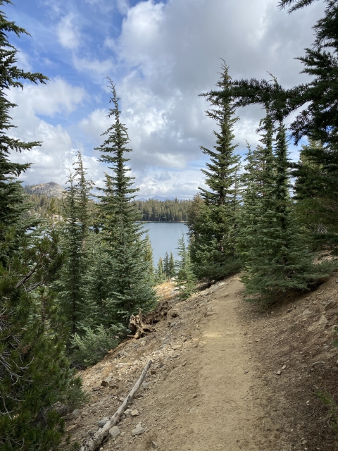
After a mile or so of very easy terrain, May Lake will make an appearance in front of you. It’s a very beautiful view and an unnamed peak reflects into to. This peak is not Mount Hoffmann. There are structures and a bathroom at the lake as it’s part of a high sierra camp.

May Lake
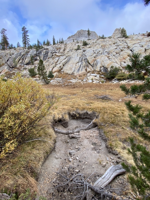
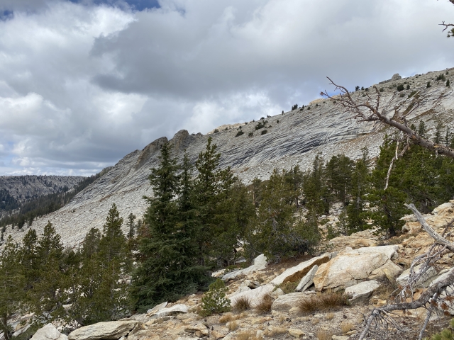
Follow the trail left around the shores of the lake and up through a little drainage. Above the drainage it starts getting rocky and the trail fades in and out. As you come above the rocks, a nice meadow sits below to the left. You will stay above this meadow and follow the trail to the right as it starts to climb through more granite slabs.

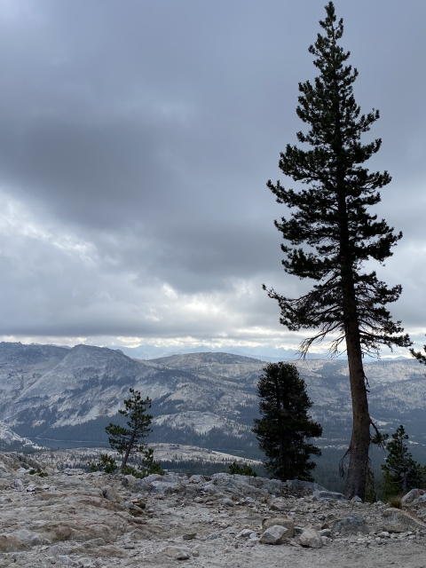
Headed up Mount Hoffmann Trail
A short distance later, the trail crests into a high basin. The Hoffmann summit lies just ahead and the radio tower gives it away. That peak you saw from the lake is now on your right.
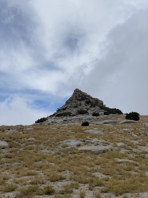
The Summit
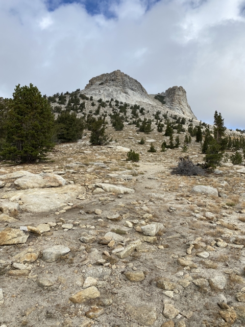
Once you pass through this high basin, the summit block is now the last obstacle. The trail peters out into the granite you will need to get a little handsy on easy class 2 terrain.

The final ascent to the summit.
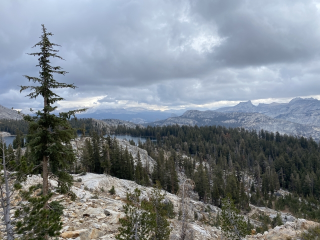
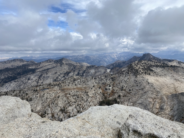
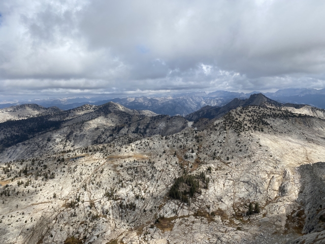
In couple minutes, the summit is obtained and arguably the best views in California come into focus. It’s quite amazing and I rank them with the views from Mount Dana and North Peak.


View towards Half Dome.
The Final Word
Mount Hoffmann is a high traffic area, so visiting on a fall weekday was much better than coming in the summer. This is a peak that is not super long or difficult and could be used as a warmup for another hike that same day or the main course. You can’t go wrong with this one at all.
Those views…man, they are something!