Signal Peak

Place Name: Washington County
Place Description: State: Utah
Date: 11/08/2021
Elevation: 10,365 Feet
Prominence: 4,485 Feet
Miles: 11.2
Elevation Gain: 4,634 Feet
Lists: Utah County High Points, Great Basin Peak List, Las Vegas Mountaineers Classic, Utah P2K
-
Difficulty
-
Solitude
-
Kid Friendly
-
Summit Views
The Monarch of St. George
If you have been to Zion National Park, it’s highly likely that you saw Signal Peak and never gave it a second glance. Located just northwest of St. George, the mountain dominates the views along I-15, however, if you are in this area you probably have red rocks and slot canyons on your mind.
Overall
3Pros
- Good access road
- Great views along trail
- Lots of peace and quiet
Cons
- Steep
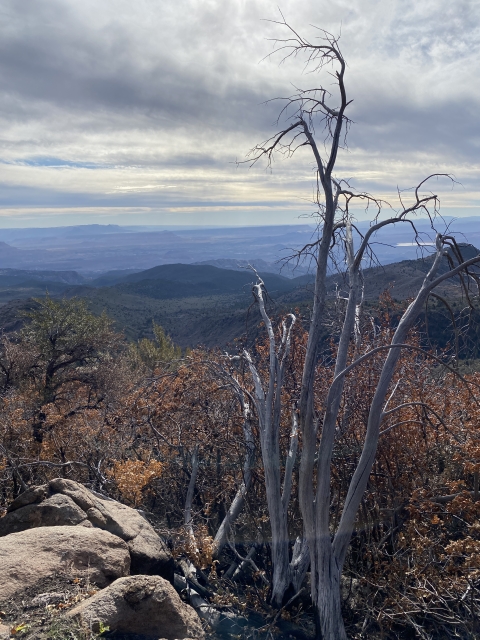
- Lower mountain burned in 2021
- No summit views
Towering over the town of St. George, Signal Peak is the most prominent mountain in Southern Utah.
While most people come to the area to see red rocks symbolic of the southwest, those who choose to see something else should check out this trail.
Signal Peak is the high point of Washington County and gives a true high country experience.
Getting There
Driving north on I-15 from the Virgin River Gorge, Signal Peak quickly comes into view. Follow I-15 and exit at the Leeds exit (exit 22).

Signal Peak from I-15.
From here, follow Silver Reef Rd through the small community of Silver Reef. This will turn into Forest Road 32 which you drive all the way to Oak Grove Campground. This road is dirt, however, it’s in great shape and passable to all vehicles.
As of this writing, Oak Grove Campground is closed. Park at the locked gate and hike 1/2 mile to the trail head.

Locked gate at Oak Grove CG.
Keep in mind, Signal Peak can be climbed from the north via the Forsyth Trail.
The Trail
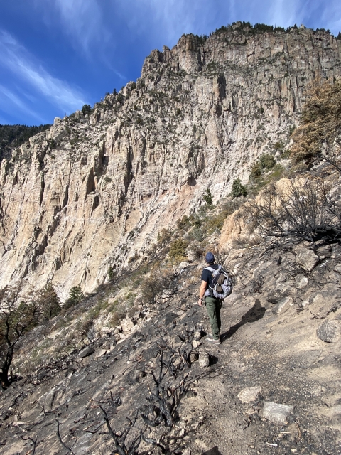
This trail gets down to business. It is all uphill. Generally it has switchbacks which help ease the gain, however, you are still climbing 3000 feet over the first 3 miles.
Starting out, the trail ascends through a burn scar and climbs over a small ridge before heading up the main face of the range.

Burn scar on lower mountain.
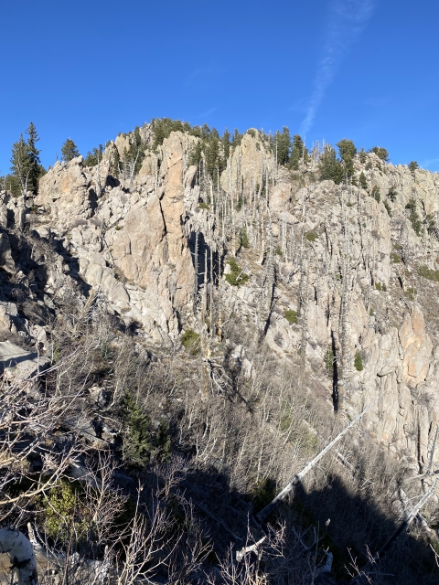
The large cliffs to the left are very impressive and beautiful. The trail never gets close to them.
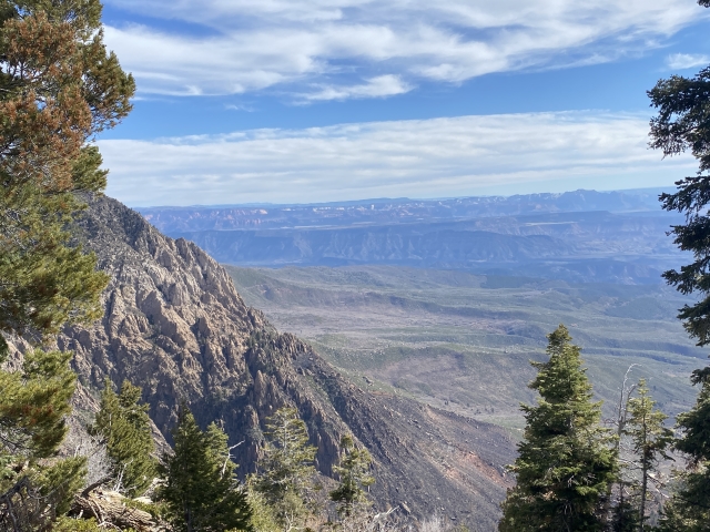
During this part of the hike, the views of Southern Utah and Zion National Park are epic.

Zoomed in view of Zion National Park.
At 9,900 feet in elevation, the trail finally crests and you will drop over into the pine forest. From here on out we mostly dealt with snow cover.

Signal Peak Trail as it enters the forest.
Moving forward, the trail descends around 100 feet to a junction sign marking Further Water and Whipple Canyon. You will be heading towards Further Water.

Trail junction. Head towards Further Water.
Deer Flat is the next landmark and is large meadow.

Deer Flat
After a little climb, Further Water is reached. This beautiful long meadow is now the trail as you walk towards the summit.

Trail passes through Further Water.
The Summit
As you climb out of the meadow and back into the forest, you will need to follow the cairns to the summit. Since this stretch had a foot of snow on it, I’m not sure if there is an actual trail through here. However, the cairns were plenty.

Snow covering off trail section on the way to summit.
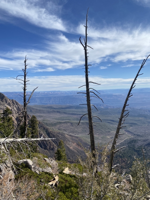
After about 300 feet of climbing the rounded and tree covered summit comes into view. Unfortunately, summit views are limited due to tree cover. Despite this, you can see peaks like Virgin Peak, Mount Bangs, and Hayford Peak.

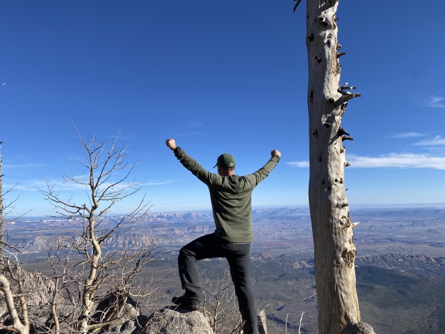
Signal Peak summit views.
The summit area is inconspicuous and the true high point is hard to find. The register is located in the rock pile where the views are.

Signal Peak summit register.
The Final Word
This trail is a grinder and will test you the entire way. I would not want to do this one in the heat of summer.
You will gain over 4,400 feet in elevation on this hike, so be ready. Further Water is a known water source, however, it was dry on my trip.
If you find yourself in Southern Utah, or even in Las Vegas, considering Signal Peak for a hike is worthwhile!