Waucoba Mountain

Place Name: Inyo County
Place Description: State: California
Date: 11/14/2020
Elevation: 11,123 Feet
Prominence: 3,923 Feet
Miles: 9.4
Elevation Gain: 4,606 Feet
Lists: Great Basin, Desert Peaks Section, Desert Summit's Book, Western States Climbers
-
Difficulty
-
Solitude
-
Kid Friendly
-
Summit Views
One Steep Slog
Like all miles in the Inyo Mountains, the miles you cover to summit Waucoba Mountain are not easy. This is a very steep and relentless climb to reach the highest point in the range!
Overall
3.5Pros
- Good road
- Pure solitude
- Pretty country
Cons
- Steep
- Long drive in
- Some bush whacking
Waucoba Mountain is one big, steep mountain and the highest point in the Inyo Mountains. The mountain also lies on many major peak lists making this a huge prize for peak baggers. Even with the accolades, this is one summit that does not receive a lot of visitation each year.
Only the most dedicated peak baggers climb in the Inyo Mountains and Waucoba Mountain is no exception. This range has a bad reputation for being desolate, dry, and rugged. After climbing Keynot Peak earlier in the year, I learned all about “Inyo Miles.”
Getting There
Getting to the TH is easy. Take Highway 168 east from Big Pine to Death Valley Rd which is paved.
Follow it to Waucoba Saline Rd. which is a maintained washboard road. Next turn right onto a rougher road to get to the parking spot at the wilderness boundary sign. There is a big turnaround here. Getting to this spot requires high clearance.

Waucoba Mountain parking area.
Google Maps will send you a different way on the way in. It will tell you to turn off of Death Valley Rd onto a two track called Waucoba Rd. Even though this road is rocky, it stays 2wd the whole way to where is meets Waucoba Saline Rd. Stay on the main roads.
The Hike
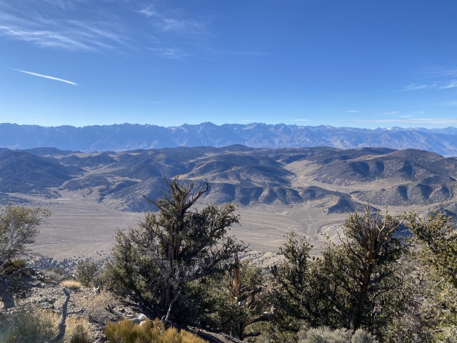
This hike is known for being steep and after some relatively easy and flat walking to start, steep is exactly what you get! After starting from the wilderness boundary it’s a mellow walk with a couple wash crossings in the forest. In the distance you can see Waucoba Mountain getting closer and closer and just how likely it will be a huge climb.

Open country and flat.
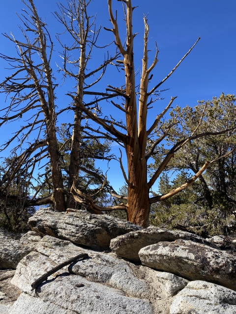
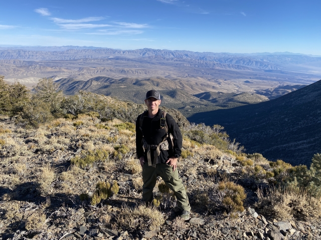
The climb starts gaining fast and never lets up. Climbing 4000 feet in just 3 miles will get you to the summit. At least it’s shaded all the way up. The entire east side is forested. Traces of snow lingered and the temperatures started dropping quickly as we made our way higher up.

Sean working his way up the slopes.
Although it’s steep, it never is difficult terrain. It’s pretty much class 1+ all the way to the top. Sporadic use trails and some cairns lead the way, however, if you are on a good line, just stick to it and use a pre-downloaded track to follow.
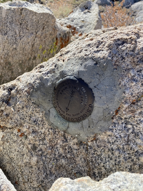
The Summit
Waucoba Mountain has a very large and rounded summit area. Meanwhile, there are a couple rock piles that make up the high point. For the most part it’s like a large meadow surrounded by forest.

On the high point of Waucoba Mountain.
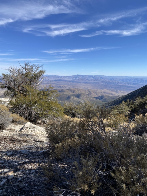
The views towards the Sierras is very nice and I wish we could have stayed a bit longer to enjoy. However, with temps in the 20 degree range and it’s tough to sit still for long. Next up is Squaw Peak.

The summit and view of the high sierras.
Squaw Peak (Wuunpu Peak)
As far as bonus peaks go, Squaw Peak is a worthy one. For instance, it sits across the saddle from Waucoba Mountain and requires a 1,500 foot drop to the saddle. The descent down the northern slopes of Waucoba Mountain is covered in thick mountain mahogany and requires some bush whacking.

Looking across at Squaw Peak.

Some bushwhacking to get to the saddle of Waucoba Mountain and Squaw Peak.
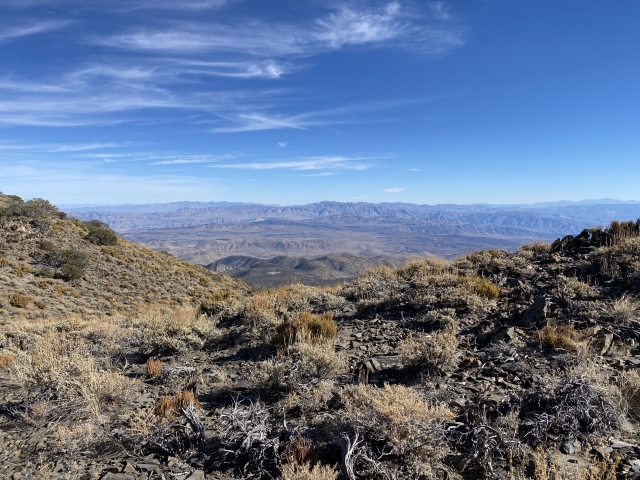
Once to the saddle, there are very nice views and some limestone rocks that need to be climbed to gain the upper areas of the mountain.

Headed into the limestone.
After some relatively easy class 2 climbing, you pop out at a large meadow which leads to the summit.

Open meadow near the summit of Squaw Peak.
Unfortunately, the summit views are obstructed by brush and trees. With a spot on the Desert Summits Book List and 10,358 feet of elevation, the trip over here is worth it.

On the summit of Squaw Peak.
After tagging the summit, start the steep descent down towards Whippoorwill Flat and the trailhead. The descent is very steep and loose in places. In other spots, it’s quite sandy and you can plunge step quickly down the mountain.

Starting our descent from Squaw Peak.
Once towards the bottom, you hike out through a very nice forest and wash. It’s mostly flat and easy walking. After all the steepness throughout the day, this was a nice section to walk.
The Final Word
In conclusion, Waucoba Mountain is a very cool mountain. Would I do it again? Maybe. It’s place on the Great Basin Peak List was the main reason I wanted this one.
If you are looking for complete isolation and a tough hike, this is a great one for you. Climbing 4,000 feet in just 3 miles will give anyone a nice challenge and leg burn. That said, if this isn’t a peak you really want, you can probably just skip it.