Mount Lola

Place Name: Nevada County
Place Description: State: California
Date: 08/09/2020
Elevation: 9,148 Feet
Prominence: 2,068 Feet
Miles: 11.2
Elevation Gain: 2,531 Feet
Lists: Tahoe-Ogul, CA County High Points, Western States Climbers List, Sierra Sampler, Sierra Club Peaks Section, US National Forest High Points
-
Difficulty
-
Solitude
-
Kid Friendly
-
Summit Views
A Trail Less Traveled In A Region Well-Traveled Trails
Mount Lola is a fun trail that gets far less visitors than most of the other trails in the area. Don’t let this think you will have it to yourself, however, you will see far less people here than you would on nearby Castle Peak or the Sierra Buttes.
Overall
2.9Pros
- Nice maintained trail
- Multiple major lists
- Lots of parking
Cons
- Dirt road approach
- Last 3/4 mile to summit is a slog
- Watch out for mountain bikes
If there was ever a mountain that hid in plain sight, it is Mount Lola. Located north of Interstate 80 and west of Highway 89, Mount Lola cannot be seen from either. Even during the hike, you never see it until you are there. As a result, Mount Lola is climbed far less often than nearby Castle Peak or the Sierra Buttes. It’s almost a shame too. Lola is the highest Sierra mountain north of I-80 and the furthest point north one can see Lake Tahoe. With over 2,000 feet of prominence, a place on the Tahoe-Ogul List, and two county high points, it’s a valuable mountain in peak bagger circles.
Getting There
Getting to Mount Lola is tad out of the way, but not difficult. It’s about a 35-minute drive from Truckee to the trail head. Coming from Truckee, the way to get there is by taking Highway 89 north towards Sierraville.
After 17 miles, there will be signed left turn for Jackson Meadows Reservoir. This road is paved. You will drive about 1.5 miles and make a left turn at the sign for Independence Lake. Take this across the bridge and after .5 miles, turn right at the junction. This road in Henness Pass Rd. It’s dirt and has some rock, but any 2-wheel drive vehicle should be fine. Follow this for a shade over three miles and you will see a big forest sign that says Mount Lola Trail and a parking area.

Mount Lola Trailhead.
The Trail
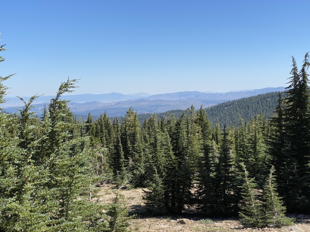
Following the Mount Lola Trail is easy. It’s a well-maintained single-track trail that works through beautiful pine forests, meadows and the Cold Stream drainage. There are ample opportunities to refill your water along the way.
The first two miles gain around 900 feet and bring you to the Cold Stream crossing. The last part of this section can be hiked on the trail or along a forest road. They go side by side for a ways and merge just before the crossing. The old bridge I’ve seen in other reports is no longer around, so you rock hopping is a must. During August, the creek was flowing nicely, however, it was easy to avoid getting wet.

Cold Stream
This section may also be able to be bypassed by driving to this location. There is a forest road that turns off to the left from Henness Pass Rd just before the trail head. That road connects to this one on the map and according to my OnX Maps, it was all government lands. The section of the road that we walked would require high clearance. There were also fresh tire tracks. So, unless there is a gate below, a truck could probably drive to Cold Stream and save a hiker 4 miles round trip and 900 feet of gain.
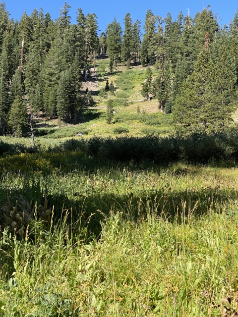
After the crossing, the trail cuts through more forest and then breaks out into the lush greens of Cold Stream Meadow. Cold Stream snakes through the grass and willows while the trail skirts along the western edge.

Trail passes through along the meadow.
Off to the right, you will start seeing open slides and ridges. There will be a couple smaller stream crossings before entering a very sparse forest. The trail makes a couple of switchbacks and before popping out near a ridgeline. From here, you can see the upper ridges of Mount Lola, however, this last .75 miles of trail is kind of a sandy slog.
The Summit
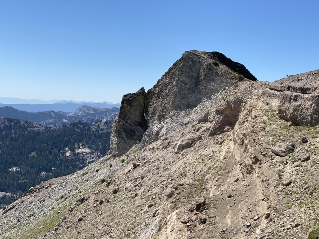
Soon enough, the views start to open up with Independence Lake and Castle Peak being the main focal points. The summit is very large area with very nice 360-degree views. There is the famous Mt. Lola sign, a couple of wind breaks, and some old brick pillars. On a clear day, the views would extend over 150 miles to the Bay Area. Directly to the south, Basin Peak and Castle Peak stand in the foreground.

Castle Peak and Basin Peak.
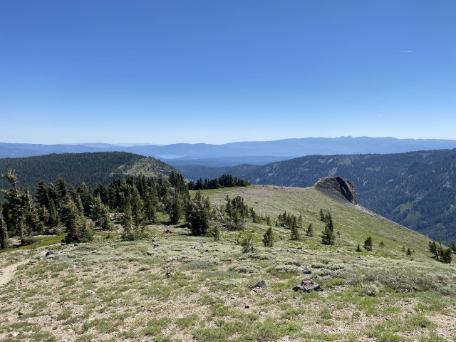
There are nice views of the Sierra Buttes, Old Man Mountain, and Signal Peak. State Line Peak in Nevada is in a direct line of site as well.

View of Signal Peak and Old Man Mountain.
This summit is the highest point in Nevada County. About 1.2 miles north, Mount Lola-North Ridge is 300 feet lower, but stands as the high point in Sierra County. We had intended to go over there, however, we were swarmed by bees on the summit and my son got stung on the hand. Since it started to swell, we decided to move off the mountain.
The Final Word
Whether or not you are a prominence chaser, county high pointer, or Ogul Lister, Mount Lola is a fantastic mountain to hike. This trail makes a great ½ day trip and could potentially be combined with other peaks in the area depending on your start time and pace. As mentioned above, checking out that road might be a sound choice and help cut down on the hike.